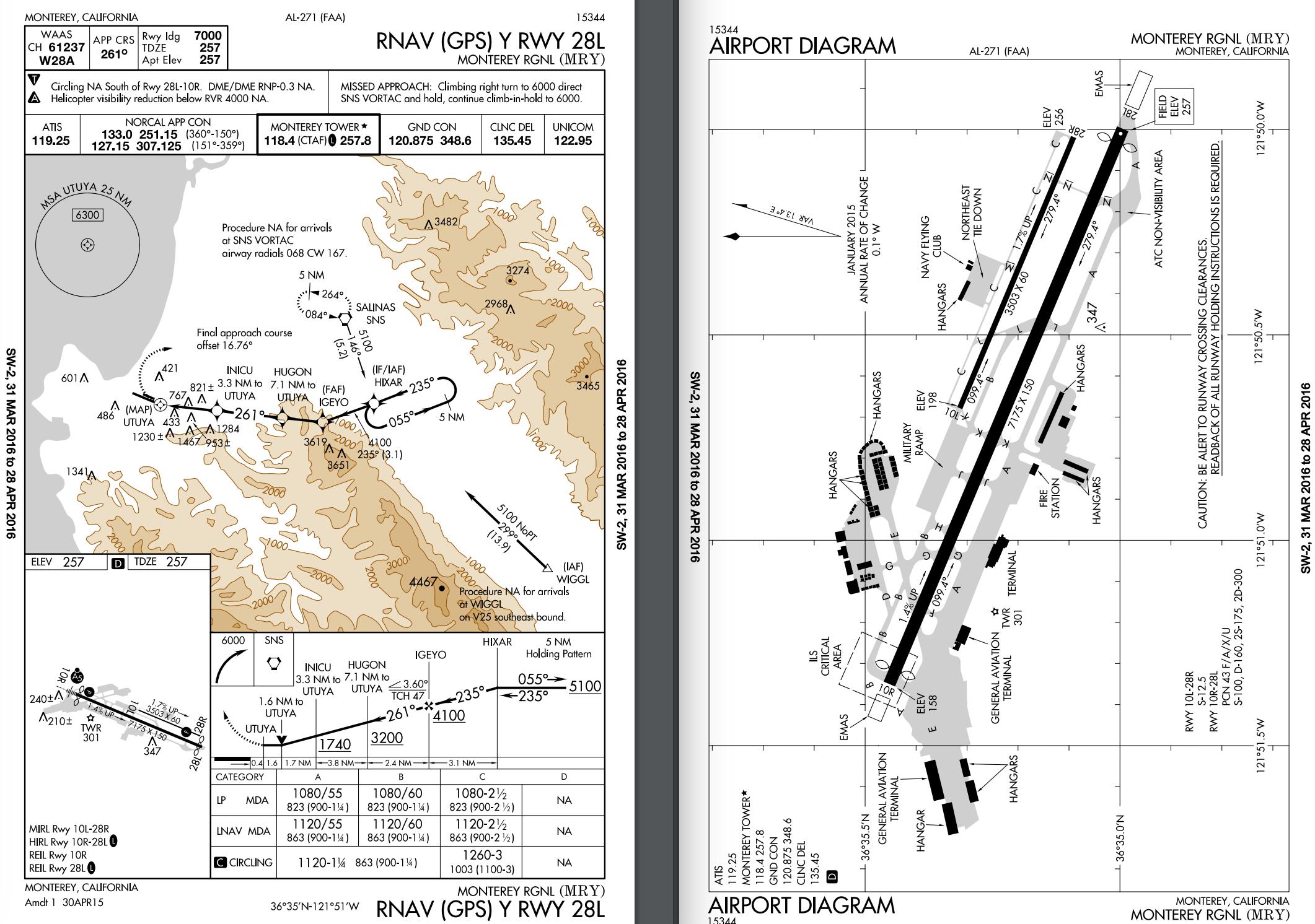
This is an interesting question because it turns out that RNAV approach criteria aren't defined in the TERPS as you would expect. Instead, there's a separate FAA order 8260.58 for RNAV approaches.
The TERPS does indeed give 30° as the maximum offset for most approaches (e.g. section 4-2-4) and 15° for VOR/DME RNAV approaches (section 13-3-4), but VOR/DME RNAV approaches are still based on ground stations (section 13-1):
VOR/DME RNAV systems use signals based solely upon a VOR/DME, VORTAC,
or TACAN reference facility. These systems use radials and distances
from a reference facility to compute position and flight track
information
On the other hand, the criteria for 'true' RNAV approaches not based on ground stations are defined in 8260.58 and they allow for offsets up to 30° for approaches without vertical guidance (section 3-2-2):
a. Offset. When the final course must be offset, it may be offset up
to 30 degrees (published separately from vertically guided) when the
following conditions are met:
(1) Offset ≤ 5 degrees. Align the course through LTP.
(2) Offset > 5 degrees and 10 ≤ degrees. The course must
cross the runway centerline extended at least 1500 feet prior to LTP
(5200 feet maximum).
(3) Offset > 10 degrees and ≤ 20 degrees. The
course must cross the runway centerline extended at least 3000 feet
prior to LTP (5200 feet maximum). For offsets > 15 degrees, CAT C/D
minimum published visibility 1 SM, minimum HAT of 300 feet.
(4) Offset 20 to 30 degrees (CAT A/B only). The course must cross the runway centerline extended at least 4500 feet prior to the LTP (5200 feet
maximum).
Since the approach you showed doesn't have vertical guidance, it would fall under this section and therefore the offset of 16.76° marked on the plate is normal.


For a non-vertically guided straight-in RNAV (GPS) approach, the final approach course must be aligned within 15° of the extended runway centerline.That doesn't conclusively answer the question, but does lead me to wonder if the LP approach is considered straight in here, but the LNAV approach is essentially considered a circling approach. But then why have the LNAV option at all? $\endgroup$