Today's airplanes cruise at 40,000 feet. Easterly flight times are longer than their westerly components due to the direction of the jet stream. Comercial supersonic flights did/will cruise at 60,000 feet. Will the force of the jet stream be as strong at this altitude and affect flight times as strongly as it is at today's cruise altitude?
-
$\begingroup$ Welcome to Av.SE, Michael! $\endgroup$– Ralph J ♦Commented Dec 18, 2022 at 18:15
-
$\begingroup$ Direction of the jet streams and prevailing winds depends on latitude, so easterly flights only take longer between +-30 and 60 degrees. The opposite is true closer to the poles and equator. see aviation.stackexchange.com/questions/2549/… $\endgroup$– PilotheadCommented Dec 19, 2022 at 11:05
-
$\begingroup$ What are the altitude of the easterly winds at the poles and equator? $\endgroup$– Michael D MaysCommented Dec 19, 2022 at 16:10
-
$\begingroup$ You need to use an "@username" to notify a commenter other than the author of the question or answer if you want a response. The prevailing winds exist at all altitudes from the ground to the jet stream and above. Speeds vary significantly by altitude and weather pattern. If you are asking specifically right at 90deg and 0deg, theoretically the answer is zero as that should be pure vertical motion. $\endgroup$– PilotheadCommented Dec 21, 2022 at 0:45
1 Answer
Wikipedia notes that
The strongest jet streams are the polar jets, at 9–12 km (5.6–7.5 mi; 30,000–39,000 ft) above sea level, and the higher altitude and somewhat weaker subtropical jets at 10–16 km (6.2–9.9 mi; 33,000–52,000 ft).
Thus, anything cruising at 60,000' should be over a mile above the highest of these altitudes, and thus wouldn't be expected to experience the same change in groundspeed that aircraft flying lower, and thus in the JetStream, would have.
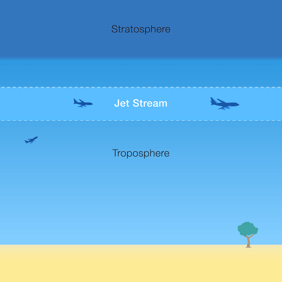
 Source: NOAA's "SkyJinks" website
One more:
"The altitude of the jet stream is a function of the vertical and horizontal distribution of temperature in the earth's atmosphere. You may recall that the earth's atmosphere is broken into several layers, or 'spheres.' The troposphere (in Latin, literally the 'turning' or 'changing' sphere) is the lowest layer of the earth's atmosphere, ranging in depth from around nine kilometers at the poles to around 16 kilometers at the equator. Within the troposphere, the temperature decreases with altitude, at a rate of approximately seven degrees Celsius per kilometer. Starting where the troposphere leaves off, the stratosphere (literally the 'layered' sphere) extends to an altitude of roughly 45 to 50 kilometers. Temperatures within the stratosphere increase with height, a phenomenon known as a temperature inversion. The transition between the troposphere and the stratosphere, called the tropopause, represents the coldest point of the troposphere. It is at this level, just under the tropopause, that the jet stream resides.
Source: Scientific American
Discussing the Concorde, Wikipedia notes that
With no other civil traffic operating at its cruising altitude of about 56,000 ft (17,000 m), Concorde had exclusive use of dedicated oceanic airways, or "tracks", separate from the North Atlantic Tracks, the routes used by other aircraft to cross the Atlantic. Due to the significantly less variable nature of high altitude winds compared to those at standard cruising altitudes, these dedicated SST tracks had fixed co-ordinates, unlike the standard routes at lower altitudes, whose co-ordinates are replotted twice daily based on forecast weather patterns (jetstreams).
