3
$\begingroup$

What are some of the best ways to retrieve and transmit the location of a plane I am in, real time.

To speak in realistic terms, I'm currently training for my private pilot's license and as such am spending a lot of time in various planes I do not own / have decision powers over. How could I share my current location with someone in a remote location while in the air without physically modifying the aircraft.

There are a couple of ideas that have come to mind, but my understand of the solutions or challenges are not complete:

  1. There are websites like flightradar24.com, but the aircraft I'm in often don't show up. That being said, a flight I took yesterday DID show up, but was not terribly accurate. Perhaps that is because I filed a flight plan and / or used flight following (which would put me on the radar tied to my tail number).
  2. I could use a simple app like "Find my Friends" on the iPhone. I realize this is crude, but it could work. That being said, I don't know how well cell phones transmit above the ground.
  3. Some other portable device. That device would need to transmit real time in some way and there would need to be some way to look up that transmission.

Any information on this would be appreciated!

UPDATE: I'm talking about general aviation here. Speeds <= 120 kts altitude typically <= 5,500

$\endgroup$
9
  • 1
    $\begingroup$ @mins he's talking about GA, which at the altitude that he's likely to fly at and the lower speeds, cellular services are not usually a problem. Lots of headsets have Bluetooth just for that purpose, music and voice calls. $\endgroup$
    – Ron Beyer
    Commented Jul 16, 2016 at 14:45
  • $\begingroup$ Hi @RonBeyer, you're correct - I am referring to GA. I am unaware of whether or not cellular service works above ground. My understanding is cellular signals transmit horizontally and have very little vertical reach which is where my concern would be around that. Is that true, or is a phone perfectly usable in flight? I've never checked while flying for the obvious reasons. $\endgroup$ Commented Jul 16, 2016 at 14:53
  • $\begingroup$ If you are wanting to share for safety reasons, look into personal locator beacons. Sportys sells them as well as other retailers. $\endgroup$
    – Ron Beyer
    Commented Jul 16, 2016 at 14:58
  • 1
    $\begingroup$ I'm curious as to why you want to share your location real time. Is it so your wife/friends can watch your progress? Just in case your CFI tries to kidnap you? In case you crash you want to be found quickly? What you're trying to accomplish by making this info available may help shape the answers you get, and point you more quickly to an appropriate solution. $\endgroup$
    – FreeMan
    Commented Jul 16, 2016 at 16:31
  • 3
    $\begingroup$ Use of a cell phone in flight generally violates FCC regulations and can violate FAA regulations as well based on determinations of the operator. While, some people do violate these regulations, you should at least consider this, and discuss it with your CFI. Here is one related article about these regulations: capmembers.com/emergency_services/operations_support/… $\endgroup$
    – Adam
    Commented Jul 16, 2016 at 22:45

3 Answers 3

4
$\begingroup$

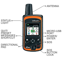
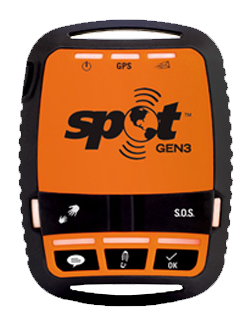
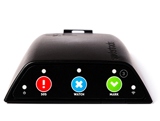
There are a few consumer-facing easy-to-obtain devices that you could use for this, although they don't quite transmit in real-time (they'll transmit updates down to every 2 minutes). Spot and inReach are aimed at more casual users, and Spidertracks offers real-time tracking that might be considered targeting more of the commercial or "prosumer" market, but they still transmit updates every 1-2 minutes.

They all work in a similar fashion: rather than some kind of ground-based radar, they utilize a combination of GPS to calculate your location and use the Iridium Satellite communications network to transmit it (so it doesn't rely on cellular signals and has global coverage), they transmit on an interval you decide to a website that your interested party could monitor. This is the key difference from other answers that use an app on a device: even if the app is linked to a real-time tracking service like Map my Tracks, your phone or tablet will still be relying on the cellular network (which you're technically not supposed to be using in flight), and even if it does work, it could be intermittent. These devices link into the Iridium Satellite network for global coverage.

The three devices are: Spot Satellite Communicator and the DeLorme (now owned by Garmin) inReach, and Spidertracks.

This isn't a free service, there is a monthly fee for using the devices.

Spot is around USD$150

inReach is around USD$350

Spidertracks start at USD$1000

In July 2016 ($USD)

inReach: Allows tracking updates every 10+ minutes ($15/month) or the 99/month package allows for updates every 2+ minutes.

Spot: 50/year allows 5, 10, 15... minute tracking update intervals or $150/year: 2.5+ minute tracking updates.

Spidertracks has various plans, basically you pay by reporting point the range is $0.05 - $0.13 per reporting point.

DeLorme inReach:

DeLorme inReach

Spot Satellite Personal Tracker:

Spot Satellite Personal Tracker

Spidertracks

Spidertracks

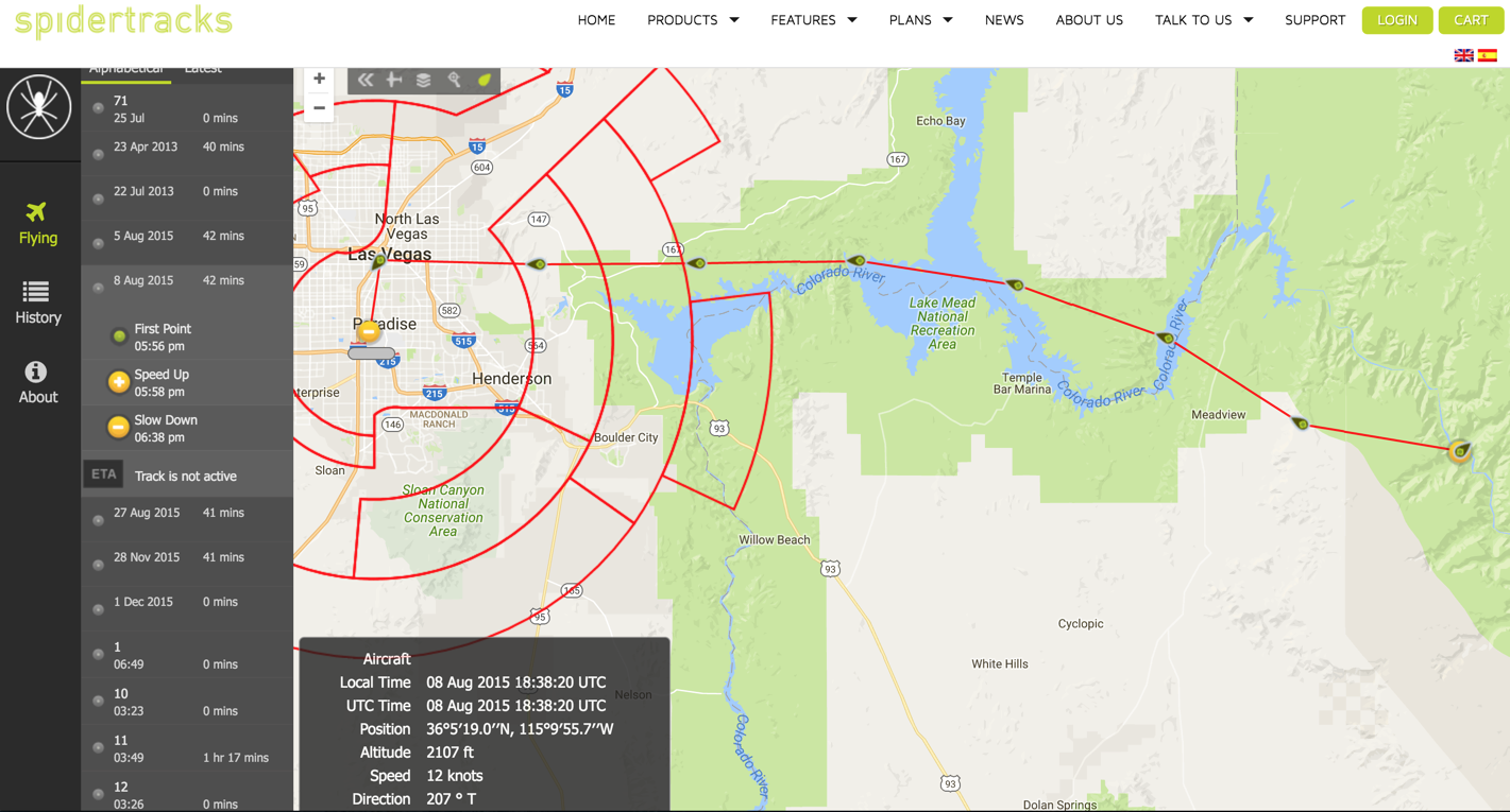
Example of the web interface from Spidertracks for real-time tracking spidertracks tracking

$\endgroup$
3
$\begingroup$

I use my Android cell-phone freeware app called Oruxmaps. It records a very detailed and correct copy of your real-time track updated many times per second. with only one drawback and that is altitude could be off by about a hundred feet.

it is also a surprisingly versatile navigation and moving-map app which allows you to use any set of charts or combination of them to fly. It gets your coordinates from your cellphone GPS, Or any tab with GPS like my Dell 8" tab.

You can set it to email your tracks to social network sites or anyone you want.

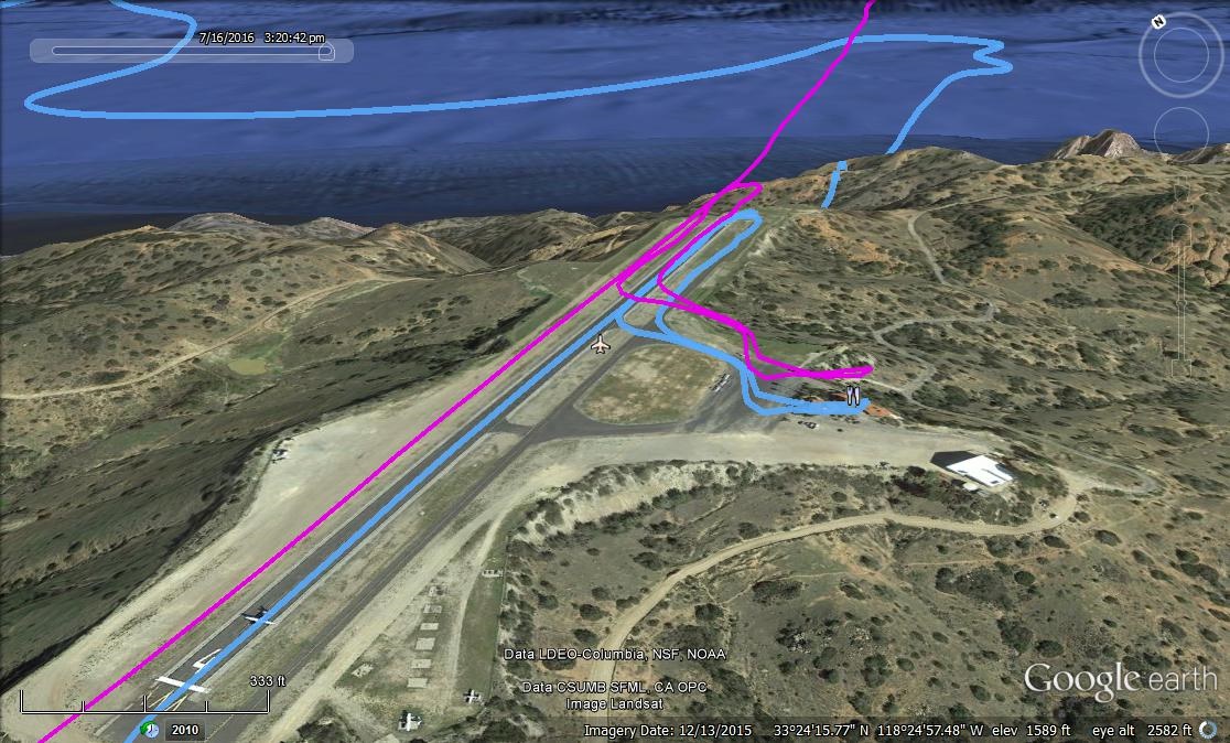
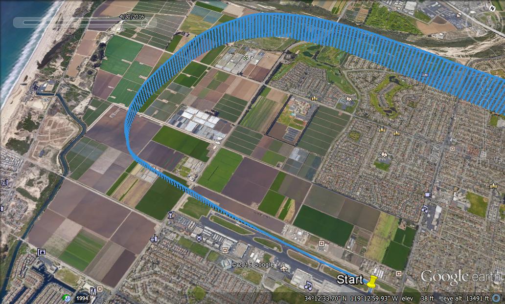
It records your tracks in small size files which you keep on a folder and can always superimpose them on Google Earth. I include some of my tracks photos I got using this app.

My flight to Catalina last Saturday:Magenta line is my track and blue is its projection on ground

My take-off from Oxnard, CA airport.

$\endgroup$
3
  • 2
    $\begingroup$ it doesn't look like this would be in real-time though, unless you linked it to Map My Tracks or some similar service. Even then, it would require the use of cellular data which is still not allowed by the FCC, and even if it were, not a reliable solution. (see related: aviation.stackexchange.com/q/1481/132) $\endgroup$
    – Canuk
    Commented Jul 26, 2016 at 8:46
  • $\begingroup$ Looks like Catalina and Oxnard. $\endgroup$
    – PJNoes
    Commented Jul 26, 2016 at 16:07
  • $\begingroup$ @PJNoes Yes it is Oxnard and Catalina. This freeware works with your phone GPS and is precise up to may be 10 feet. You can also set it up to automatically send out stress texts if you are not on time on you waypoint, or destination. I usually use it just for navigation and down load my tracks later. $\endgroup$
    – kamran
    Commented Jul 26, 2016 at 17:25
-1
$\begingroup$

You should consider aquiring an ADS-B transmitter. This is the new standard, growing rapidly, and it's what lets you be visible in sites like flightradar24 or others.

AFAIK, it uses your transponder in mode S to broadcast (to air AND ground) a bunch of information, like aircraft position, speed, altitude, heading, ...etc.

It is already used by most commercial airliners, small jets, and even piston driven aircrafts, and is considered the technology to be used in the near future, in respect of the FANS-1/A specification.

$\endgroup$
1
  • 1
    $\begingroup$ This would need to be fitted to the aircraft itself. The OP specifically asked for a solution that does not require modification of the aircraft, as he flies more than one aircraft. $\endgroup$ Commented Jul 27, 2016 at 12:29

You must log in to answer this question.

Not the answer you're looking for? Browse other questions tagged .