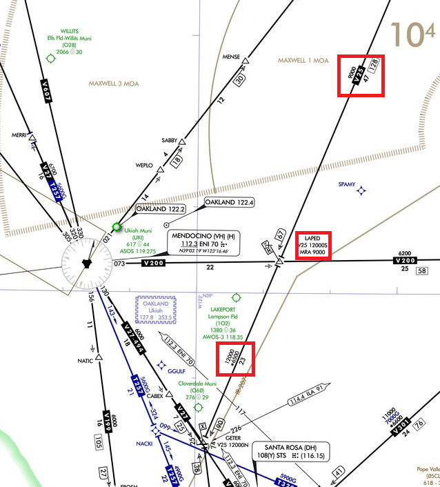
I found something curious about the V25 route on the en-route low altitude chart. Before LAPED, there was no MOCA indicated, only an MEA of 9000. Why does MOCA 6500 appear after LAPED?

1 Answer
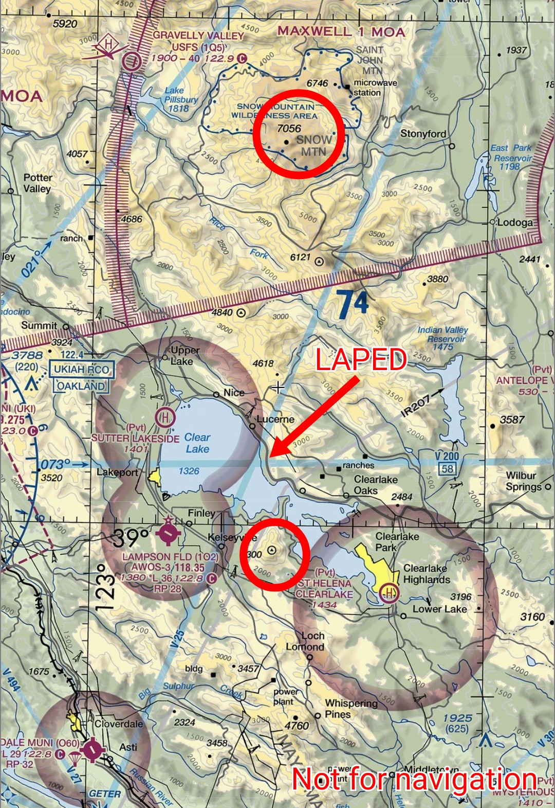
Terrain. It's easier to see if you look on the VFR chart instead. Heading southbound on V25, there is terrain up to about 7000 feet on V25 before LAPED. After LAPED, the highest terrain is only 4300 feet, so the MOCA can drop.
On the other hand, the VOR signal from RBL is blocked by that high terrain at lower altitudes. The farther past the high terrain you are, the higher you need to be to receive the VOR signal, which determines the MEA.

