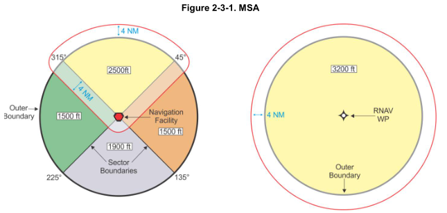
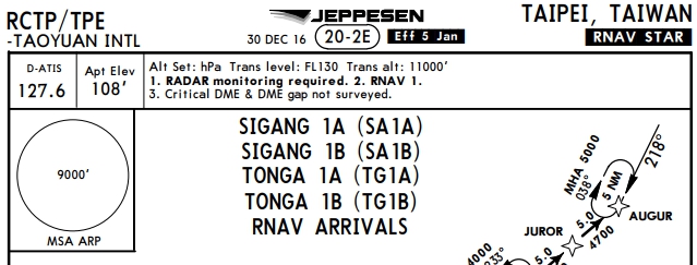
In 2012 South Korea presented to ICAO design issues with regard to PBN, of those design issues was the reference point for the MSA:
(...) in terms of PBN procedures, every component which is used for RNP approaches or RNP AR approaches, such as waypoint, variation, track and buffer value etc. is based on the airport reference point (ARP). Therefore, it is more reasonable that MSA for PBN Procedures should be centered on the airport ARP, instead of the navigational aids.
Since the old sectors were based on the VOR radials, which is now no longer the reference point after the introduction of the PBN elements, they simply take the highest sector (8,800 ft) and round it up (9,000 ft) to be the MSA for the whole 25 NM.
For uniformity, even the radio based approach (see below) now uses the same reference point as the RNP (RNAV) one. (The one on the left is an old MSA from 2016.)

ICAO's PBN mission is to have uniform specifications and cost-controlled implementation of procedures. So this 'common area' as opposed to the different sectors makes certifying and approving a procedure much easier and cheaper, and puts less strain on the minimum capabilities required from the airborne navigation equipment.
A basic GNSS unit doesn't say which radial/track to a point it is on if it is following a different point, whereas for the VOR reference point, looking at the RMI or spinning the OBS knob for the tuned VOR is pretty straight forward.
This is echoed by the FAA in the TERPS manual, page 2-17. However, note the different points required by the FAA:
RNAV procedures. For RNAV straight-in approach procedures, establish a common safe altitude within the specified radius of the runway threshold (preferred) or the MAP waypoint (WP); for RNAV circling procedures use the airport waypoint (APT WP).

The charts are from the official Taiwanese AIP: http://eaip.caa.gov.tw/eaip


