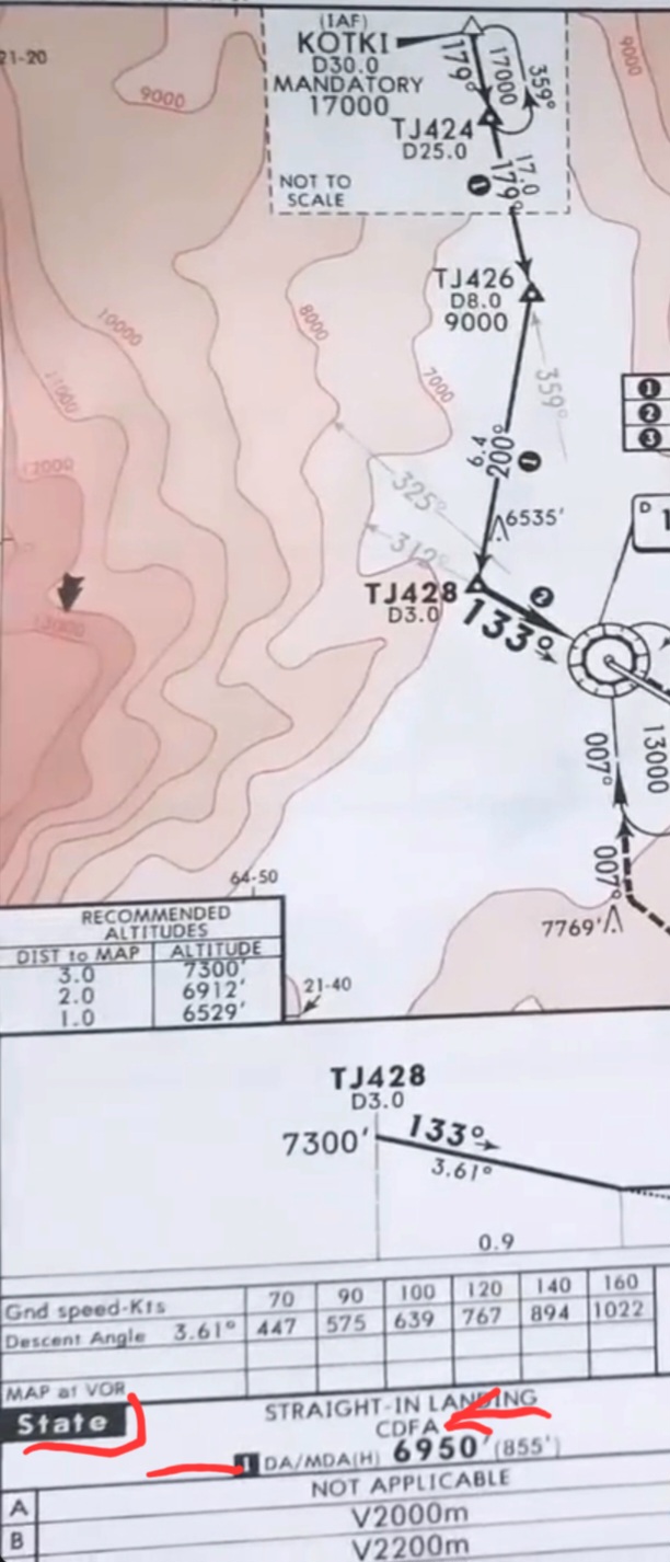
I have some questions about certain VOR approach charts. I find some details confusing on the following chart for SLTJ VOR C Rwy 13:
- What does "state" mean? It's in bold in the minima section.
- Why is there a bold "1" next to the minima?
- Referring to a non-precision VOR approach chart, why is the minima stated as 1DA/MDA 6950'? Shouldn't it be just MDA? The number "1" is also next to it.
- Above the minima, what do the initials CDFA stand for?


