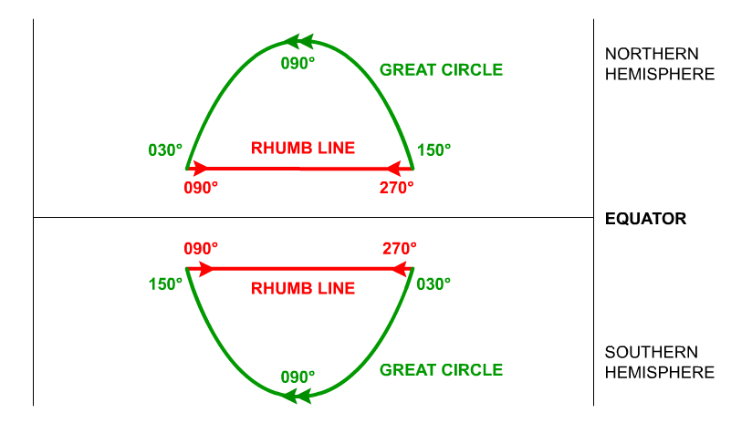
I have no idea where the image comes from, but it seems that you have spotted an inconsistency/copy-paste typo.
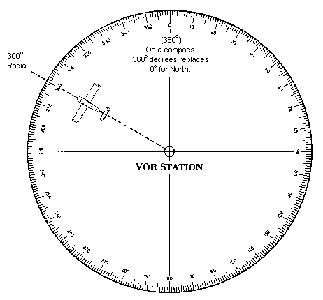
Let's remember that the heading is always measured w.r.t. the north, increases in a cloclwise fashion and indicated the direction the aircraft is flying to, as shown in the following figure:

(Image Source: www.allstar.fiu.edu)
On the Rhumb line both East and West directions are shown both with arrows ($\rightarrow \;\; \leftarrow$) and with the initial headings ($90^o \;\; 270^o$)
On the Great Circle lines only the westerly arrows appear and only the starting headings from the West are correct. These seems to have been copied to the East side, but they should have also been augmented by $180^o$, i.e. as you were expecting, you should have $330^o$ for the northern hemisphere (in lieu of the $150^o$) and $210^o$ instead of $30^o$ for the southern.


