I have a question perhaps best demonstrated with this image:
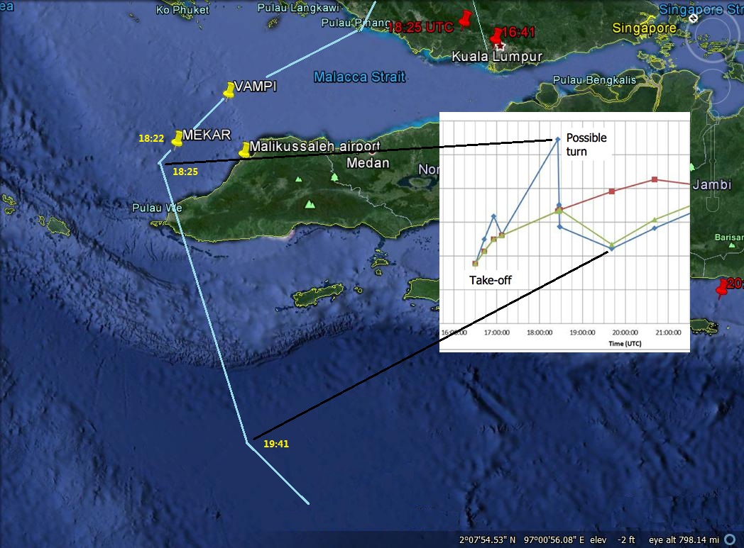
Malaysia published two maps with the preliminary accident report which allege MH370 flew west from Penang to MEKAR (above Aceh Province) and then between 18:25 UTC and 19:41 UTC flew west into the Indian Ocean.
The problem is the Burst Offset Frequency chart published 24 March shows a frequency drop after 18:25 UTC signifying flight away from the satellite.
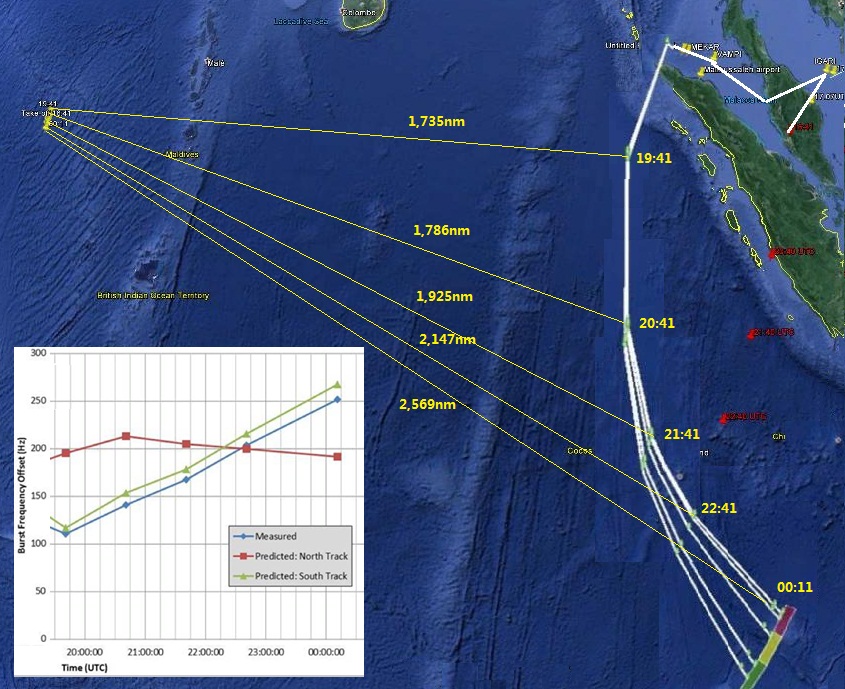
After MH370 allegedly emerged from the Straits and turned south the track which Malaysia's Preliminary Accident Report claims MH370 flew (based on their analysis of the BOF chart data) the track makes even less sense because the distances away from the satellite continue to increase.
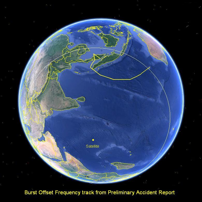
And this image shows the distance relationship with the satellite:
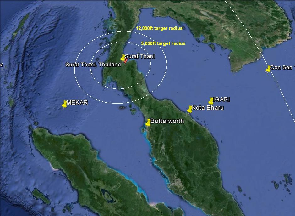
There are also other (non satellite) reasons to question the validity of the alleged track through the Straits of Malacca. First is the claim MH370 was seen flying west by radar at Surat Thani in Thailand. That radar has a published maximum range of 200nm. Kota Bharu is 240nm away from Surat Thani.
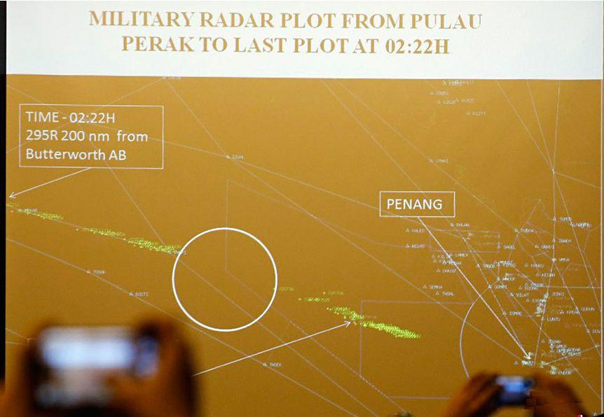
This is not the only reason to doubt the alleged MH370 flight though the Straits. Malaysia presented this image to Chinese relatives at the Lido hotel in Beijing on 21 March and told them it was a military radar image from Butterworth of MH370 in the Straits of Malacca. They said it crossed the island of Pelau Perak at 18:02 UTC and disappeared at 18:22 UTC.
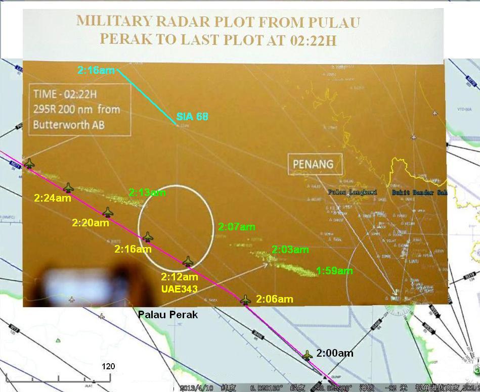
The image however omits other aircraft known to be present at the same time:
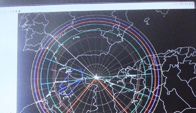
Worst inconsistency of all however is this, the radar image does not even come from the Butterworth radar. The real military radar used by Butterworth is a Thales Raytheon GM400 which has a screen display like this:
I don't understand how so many supposedly intelligent "experts" and journalists have managed to be deceived for so long except to say people believe only what they want to believe and shut their eyes to the truth.
Australian, Malaysian, Japanese, New Zealand and Chinese taxpayers collectively forked out $90m wasted taxpayer dollars for a search at the end of this projected BOF track in April which turned up no result.
My question is how does this mutually incompatible information prove MH370 flew west through the Straits at all?
