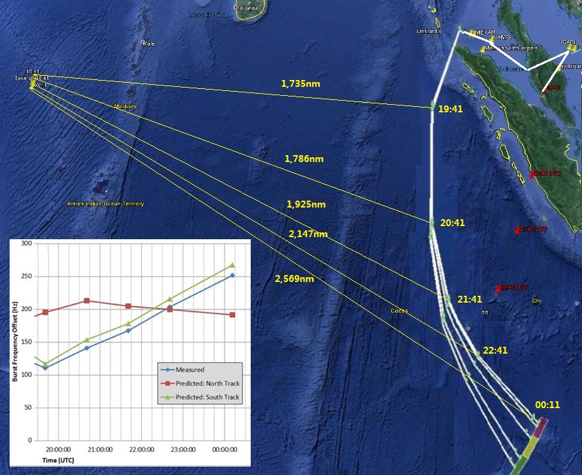
This image illustrates my question:

In the Burst Offset Frequency chart from 19:41 UTC until the final ping at 00:11 UTC the blue track for MH370 shows increasing frequency, which means flying towards the satellite.
Therefore for the Burst Offset Frequency chart to be correct the flight track in maps released by the preliminary accident report should have curved west not east.
If they were fundamentally so wrong how could this ping chart ever have been used to plot the final location of MH370?
