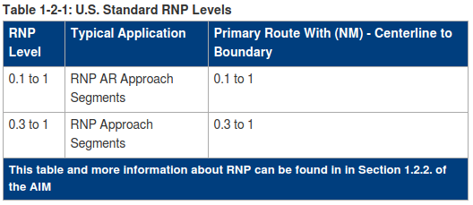
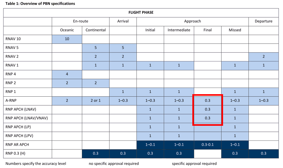
RNP (Required Navigational Performance) approaches require the aircraft to monitor the navigation accuracy within a specified limit, called RNP level:
There are several different levels of RNP. Examples of RNP levels used for approach include RNP 0.1, RNP 0.3, and RNP 1.0 (There are also RNP 4.0 and RNP 10.0 levels that apply in the en route environment). "A performance value of RNP 0.3, for example, assures that the aircraft has the capability of remaining within 0.3 of a nautical mile to the right or left side of the centerline 95 percent of the time."
[...]
The minima line will include a performance value, RNP 0.30 for example. GPS with WAAS can support RNP 0.3 and above.
(faa.gov on Satellite Navigation)
Usually the RNP level is given in the minima section of the approach chart (and according to the above FAA quote, this is always the case in the US). There are however approach charts that do not include this. Consider for example the following 3 approaches into Innsbruck (LOWI), Austria. While the first example lists the RNP levels, the other two do not:
RNP Z RWY 26 (AR)
There are two different minima for the different specified RNP levels.
RNP E RWY 26 (LPV ONLY)
There is no RNP level specified, also not anywhere else on the chart (as far as I could find). Maybe this is because this approach is LPV only (requires EGNOS1)?
RNP Y RWY 08
Again, there is no RNP level specified and this time there are only LNAV minima. So which RNP level would apply here?
1 EGNOS is the European SBAS (Satellite Based Augmentation System), equivalent to the North American WAAS.


