NOTE-- this question is not about why it was desired to protect the airspace that ended up within the E4 "extensions". Rather, this question is about why that was done by designating that airspace as an E4 "extension" rather than simply as part of the E2 airspace that surrounds the airport, which is the more common situation for untowered airports.
What is the primary reason that the (U.S.) non-towered airports ACV, TVL, SGU, BIH, and SIT/PASI all feature E4 Class-E-to-surface "extensions" to the E2 Class-E-to-surface airspace that surrounds the airports?
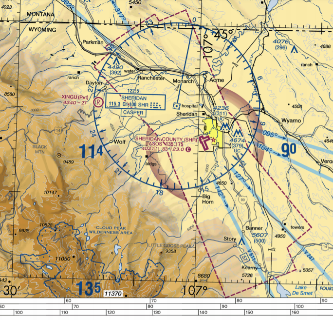
Why was the airspace not simply all designated as E2 Class-E-to-surface airspace, as was done at SHR?
Is there some established guidance that areas of Class-E-to-surface airspace projecting beyond some given distance beyond the airport whose approaches they protect should be designated as E4 airspace rather than E2 airspace?1 Or is it up to the discretion of the team designing the airspace in each specific case?
There is arguably some regulatory ambiguity around the operational significance of the distinction between E2 airspace and E4 airspace. Certain FARs pertaining to eligibility for Special VFR clearance, VFR operations under a 1000' ceiling without a Special VFR clearance, ultralight operations, unmanned aircraft operations, aerobatics, and more, might arguably be construed to apply to E2 airspace but not to E4 airspace. (For more on this, see this related ASE question, and the other related linked questions.) Was the FAA designing the airspace around these airports with an eye to minimizing the amount of airspace to which these FARs would be applicable, to lift the regulatory burden on certain aviation activities? And/or to limit the amount of airspace in which pilots would be eligible to be granted a Special VFR clearance?
Or was there some other consideration that was the primary reason that the airspace at these airports was designed to have an E2 "Surface Area" with E4 "extensions"?
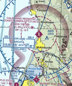
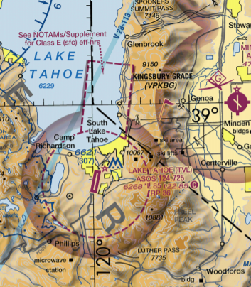
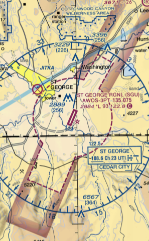
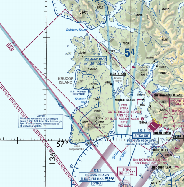
Bonus question-- why was the airspace portrayed differently on the VFR sectional charts in the first two examples (ACV and TVL) than in the last three examples (SGU, BIH, and SIT/PASI)?
Note that for ACV and TVL, on the depiction on the sectional charts, there is a dashed magenta line separating the rectangular E4 "extensions" from the circular E2 airspace around the airports.
ACV-- California Redwood Coast Humboldt County airport near Arcata CA
Airspace description in FAA JO 7400.11E-- pp. E-130, E-2122
TVL-- Lake Tahoe Airport, South Lake Tahoe CA
Airspace description in FAA JO 7400.11E-- pp. E-136, E-2213
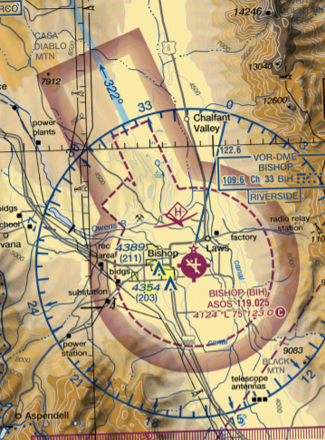
Note that for SGU, BIH, and SIT/PASI, on the depiction on the sectional charts, there is no dashed magenta line separating the rectangular E4 "extensions" from the circular E2 airspace around the airports. Yet in all three of these cases, the rectangular projections are in fact designated as E4 "extensions", as distinct from the E2 inner circles, just as is the case at ACV and TVL:
SGU-- St George Regional Airport, St George UT
Airspace description in FAA JO 7400.11E-- pp. E-82, E-193
BIH-- Bishop Airport, Bishop CA
Airspace description in
FAA JO 7400.11E-- pp. E-131, E-2134
SIT/PASI-- Sitka Rocky Gutierrez Airport, Sitka, AK
The 2/25/21 Juneau sectional chart portrays a recent airspace change effective 11/5/20 (pictured below)-- the new airspace definitions may be seen here (E2) and here (E4, after an error was corrected). The airspace now features a very large E4 "extension". The old airspace configuration, which at present may still be seen on vfrmap.com, featured an L-shaped area of E2 airspace, with no E4 extensions.
Note that there are other examples of (U.S.) airports that feature large expanses of Class-E-to-surface airspace, with no control tower in the vicinity, where the entire airspace was simply designated as E2 airspace, with no E4 "extensions". One of the best examples of this is SHR:
SHR-- Sheridan County Airport, Sheridan, WY
Airspace description in FAA JO 7400.11E-- p. E-91
Footnotes:
E.g. something similar to this guidance regarding E4 extensions to Class D airspace: "If all arrival extensions are 2 NM or less, they will remain part of the basic Class D area. However, if any extension is greater than 2 NM, then all extensions will be Class E airspace."-- from FAA Order JO 7400.2L "Procedures for Handling Airspace Matters". Also appears as AIM 3-2-5 d1.
All images are clipped from screenshots of the 2-25-2021 editions of the relevant VFR sectional charts, accessed via this FAA webpage. All are intended to be to same scale.
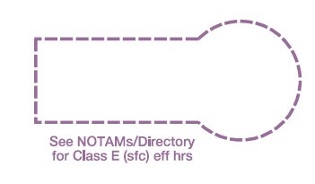
Note that at TVL, but not at ACV, the chart bears a notation "See NOTAMs/Supplement for Class E(sfc) effective hours", with an arrow pointing specifically to the E4 "extension". The current Chart Supplement, however, simply states "Airspace: Class E". To the best of my knowledge, this has been the case ever since the E4 airspace was first created at this location. The E4 airspace description for TVL in the "Airspace Designations and Reporting Points" document JO 7400.11E does include the note "This Class E airspace area is effective during the specific dates and times established in advance by a Notice to Airmen. The effective date and time will thereafter be continuously published in the Airport/Facility Directory. " Perhaps there was a desire to facilitate making the E4 extension part-time for some reason in the future, by simply changing the Chart Supplement? In all the other E2 and E4 airspace descriptions referenced in this question, there is no indication that any of the airspace is intended to be in effect less than 24/7.
The hang gliding symbol within the E2 Class-E-to-surface airspace at BIH is rather "interesting", considering the language of FAR Part 103.

