6
$\begingroup$

I'm writing a story about the pilot of the Austrian Air Force, who uses his Eurofighter Typhoon aircraft for unintended purposes. In scope of another question we figured out that by turning off the transponder the pilot could make the aircraft invisible for the cooperative surveillance.

However, the primary radars detect a flying object regardless of whether it responds or not. This means that if a pilot of a Eurofighter turns off the transponder, civilian ATCs wouldn't see his plane, but he would remain visible for the military ones.

I assume that there are "blind spots", i. e. areas where primary radars can't detect aircraft. I believe this to be true because if primary radars covered 100 % of the airspace, the location of the Malaysia Airlines Flight 370 would be known.

Where exactly are these blind spots (if any) in Austria (areas in which primary radars of the Austrian Air Force would not detect flying objects) ?

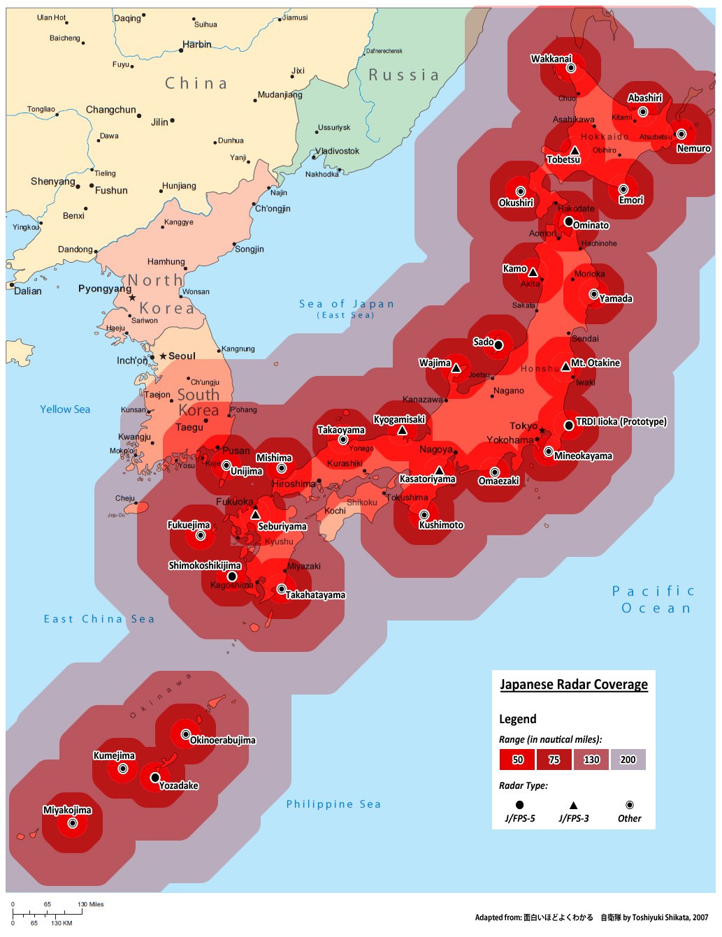
I'm looking for a map like this for Austria:

Radar coverage map of Japan

Source of the image

$\endgroup$
3
  • 2
    $\begingroup$ I would be seriously concerned if the Austrian military published a handy map of blind spots in their defense system. :P $\endgroup$
    – TomMcW
    Commented Apr 2, 2017 at 21:53
  • 1
    $\begingroup$ OP said: "This means that if a pilot of a Eurofighter turns off the transponder, civilian ATCs wouldn't see his plane, but he would remain visible for the military ones." Just to clarify, civilian radars (when used) ALSO use primary radar. They would see "something", but with no xpdr to answer, they wouldn't know who or what the "something was". In Austria, the same radars are used for both military and civilian purposes. $\endgroup$
    – Jimmy
    Commented Apr 2, 2017 at 22:12
  • $\begingroup$ In the picture in the answer below, the primary radar is the big square on bottom, and the secondary radar is the smaller rectangle on top. Even though these are military radars, civilian radars look very similar with the smaller secondary radar mounted on top of the large primary radar. $\endgroup$
    – Jimmy
    Commented Apr 2, 2017 at 22:13

1 Answer 1

10
$\begingroup$

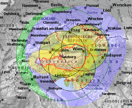
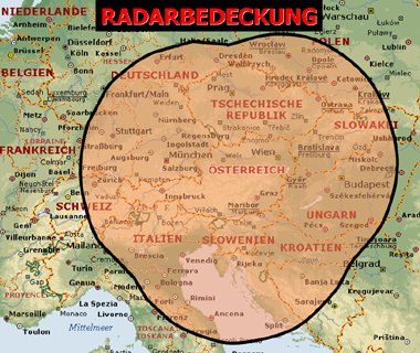
The radar system in Austria is know by the name Goldhaube (Golden Hat). It is based on 3 fixed sites and several mobile stations. The coverage is this one:

enter image description here
Source

Another view:

enter image description here
Source

The three primary surveillance radars (PSR) are located at:

and are (or were) Selenia RAT-31 with a range of about 300 NM.

enter image description here
Source


Side notes

The difference between Austria and some incompletely covered areas is that Austria is not a large territory like China nor a water area like the Indian Ocean. It is relatively easy to get a full coverage.

In addition Austria is mountainous (famous ski resorts), so it's quite handy to use peaks for radar stations with increased range.

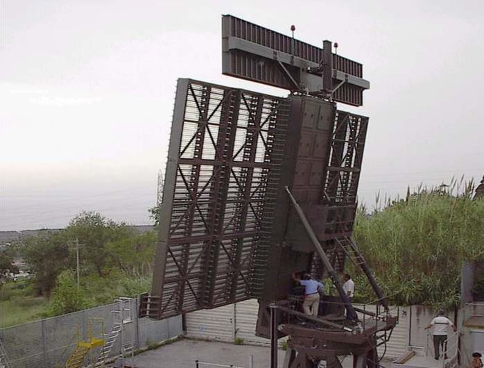
However, radio waves are mostly traveling in straight line. At low altitude in the valleys an aircraft is invisible. Military use this tactic under the name "ground hugging" or "nap-of-the-earth" to escape unfriendly eyes. Austrian army use mobile radars to make this possibility more complex:

enter image description here
Source

And to fuel imagination, there is this story of aircraft vanishing over Austria. Possibly a Bermuda triangle at the core of Europe.

$\endgroup$
5
  • $\begingroup$ The Daily Fail is unfortunately known for pulling stories out of thin air. Can you find a more reputable source for that last story? I tried to find it on The Aviation Herald, but couldn't (at this would be significant enough to get covered there). $\endgroup$
    – Jan Hudec
    Commented Apr 2, 2017 at 21:02
  • 1
    $\begingroup$ @JanHudec I can confirm it occurred. It took a bit more than a couple of days to find out what caused it. $\endgroup$
    – DeltaLima
    Commented Apr 2, 2017 at 21:14
  • 2
    $\begingroup$ I googled a bit, and it seems that the vanishing, on two different days, was due to a NATO manoeuvre. The term NEWFIP was used. $\endgroup$
    – Carsten S
    Commented Apr 3, 2017 at 0:34
  • $\begingroup$ "NATO Electronic Warfare Force Integration Programme (NEWFIP) is the Allied system-training designed to provide integrated and coordinated training to NATO forces on operating in an adverse electromagnetic environment. " - sounds plausible enough. $\endgroup$
    – MSalters
    Commented Jan 18, 2023 at 21:42
  • 1
    $\begingroup$ @JanHudec and other persons interested: This incident was investigated by EASA which found an over-interrogation by an unknown device near Prague (CZ): "this over interrogation of the 1030 MHz frequency was most probably caused by a system or installation that was either in test or in an unusual operational mode. Furthermore, it has been concluded that it is very unlikely that the events were caused by weather phenomena or other natural causes, military exercises or security threats." $\endgroup$
    – mins
    Commented Jan 18, 2023 at 23:24

You must log in to answer this question.