17
$\begingroup$

To the Northwest of the KMCI Class B airspace, there is a strange cut out in SFC/80 airspace, which I highlighted at this link (and shown in picture below):
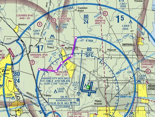
KMCI
highlighted in purple - Image Source: www.skyvector.com

There's no airport there, and no obvious reason for the cut out.

What possible reasons could there be for a strange shape like this?

$\endgroup$
2
  • 2
    $\begingroup$ Note that the circle with the 'R' in it is an airport. The "ELTON (Pvt)" label on the map applies to it. It's the field listed as 'B' in rbp's answer. It does seem odd that the other one isn't charted, though. $\endgroup$
    – reirab
    Commented Jan 7, 2015 at 22:10
  • 2
    $\begingroup$ it seems like it might be the other way around: you have to file a form to add a private airport to a chart: "To register a private use airport with FAA or make changes to an existing private use airport, complete FAA FAA Form 7480-1 Notice of Landing Area Proposal (PDF) in according to the instructions." faa.gov/air_traffic/flight_info/aeronav/faq/#q3f $\endgroup$
    – rbp
    Commented Jan 8, 2015 at 13:17

1 Answer 1

13
$\begingroup$

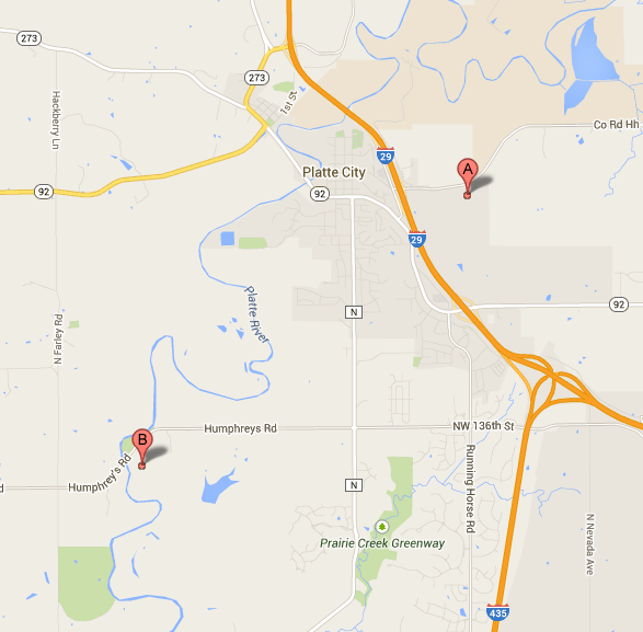
There are in fact two airports in the cutout:

enter image description here

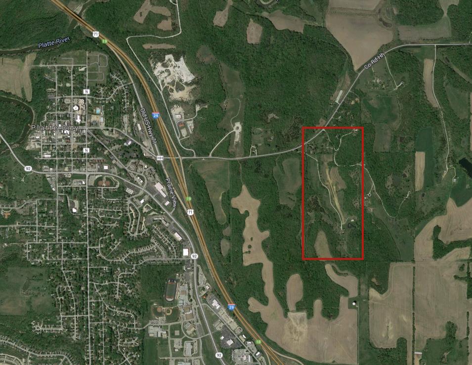
  1. An unmarked field (A in top map) just east of Platte City (see below) that corresponds to the NW limit of the cutout. Note that this edge of the cutout appears to parallel the main runway at MCI.

enter image description here

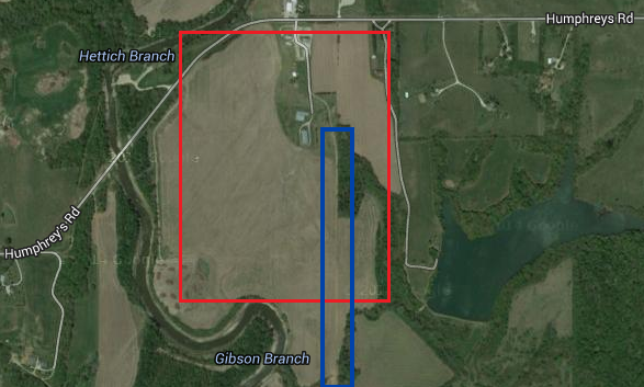
  1. The private Elton Field (B in top map). In the image below, field is boxed in red and runway in blue.

enter image description here

And there's also the VFR reporting point over north Platte City

$\endgroup$
5
  • 2
    $\begingroup$ Thanks, I didn't realize they'd customize a Bravo space for a private field, much less an unmarked one! $\endgroup$
    – abelenky
    Commented Jan 7, 2015 at 18:56
  • 3
    $\begingroup$ because of the N/S and E/W configuration of the runways, the cutout doesn't interfere with arrivals and departures, and indeed it looks like the NS and EW sections of the cutout parallel the runways; usually cutouts like this are radials and DME arcs off a VOR. $\endgroup$
    – rbp
    Commented Jan 7, 2015 at 18:58
  • 4
    $\begingroup$ @abelenky I think they also did it so that those two airfields are not in Class B. @ rbp's reason of runway directions probably made it easier to make this cutout decision. $\endgroup$
    – Farhan
    Commented Jan 7, 2015 at 19:08
  • 1
    $\begingroup$ unfortunately for the guy landing at Elton, there's only one way in (south) and one way out (north), without busting Class B $\endgroup$
    – rbp
    Commented Jan 7, 2015 at 19:10
  • 4
    $\begingroup$ Both these airstrips were there before MCI ever existed. The unmarked one to the East was the VP Engineering at TWA, his Private strip. Flew his Comanche & Ercoupe to MCI for work before it became a Comnercial field while TWA was still based at MKC. TWA maintenance base at MCI was operational 4 years before the terminal was finished. $\endgroup$
    – R Bullock
    Commented Sep 26, 2018 at 17:49

You must log in to answer this question.

Not the answer you're looking for? Browse other questions tagged .