It is said that there are some places where class G goes up to 14500 and then class E starts. However, I find they all overplayed with some special use airspace by looking at NorCal and SoCal Sectionals. Can anyone point me to some non-trivial 14500' Class G places? It is best to see some civilian airport within it.
-
$\begingroup$ Are you only looking for examples from the USA? $\endgroup$– 60levelchangeCommented Jun 23, 2016 at 6:23
-
$\begingroup$ @J.Hougaard Yes, I am for answers in US in this question. $\endgroup$– CrepuscularVCommented Jun 23, 2016 at 6:25
-
1$\begingroup$ @falstro: In US, Class E may start from surface, 700, 1200, 14500, and sometimes a customized AGL. $\endgroup$– CrepuscularVCommented Jun 23, 2016 at 7:06
-
$\begingroup$ Ah, you're right there's also the jagged blue line. Forgot about that one. There's some funky E space over Nevada. :) $\endgroup$– falstroCommented Jun 23, 2016 at 7:18
-
$\begingroup$ @falstro "in the lower 50"? Usually, the "lower 48" refers to the contiguous 48 states, excluding AK & HI. Was that a typo, or is that an aviation reference that I'm totally unfamiliar with? $\endgroup$– FreeManCommented Jun 24, 2016 at 17:39
5 Answers
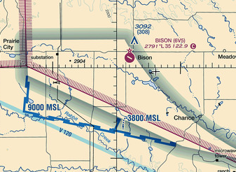
It can be difficult to find these areas on a VFR sectional (there are very few of them anyway), but on an (FAA NACO) IFR en route chart they're shaded brown, so they stand out very clearly from the background. Here are a few grouped together in South Dakota.
IFR chart:
VFR chart:
At the western end of those areas there's a public airport, Bison Municipal (6V5):
-
1$\begingroup$ There's so few of them it's a wonder they even bother to define it as 14500 $\endgroup$– TomMcWCommented Jun 23, 2016 at 17:32
-
1$\begingroup$ The highest peak in continental US is Mount Whitney at 14,505'. Class E starts at 14,500. Probably not a coincidence. $\endgroup$– JScarryCommented Jan 3, 2017 at 21:48
-
6$\begingroup$ @TomMcW This has changed substantially in the last 10-15 years. When I started flying there were lots of areas that I was familiar with that were Class E starting at 14,500. Now all those areas are gone, and only a few examples remain in the lower 48. I expect to see the trend continue, with a chance that current definitions may indeed become obsolete and superseded. $\endgroup$– J WCommented Apr 2, 2017 at 4:13
-
$\begingroup$ @Pondlife All of your examples are now gone. $\endgroup$– StephenSCommented Oct 22, 2022 at 6:05
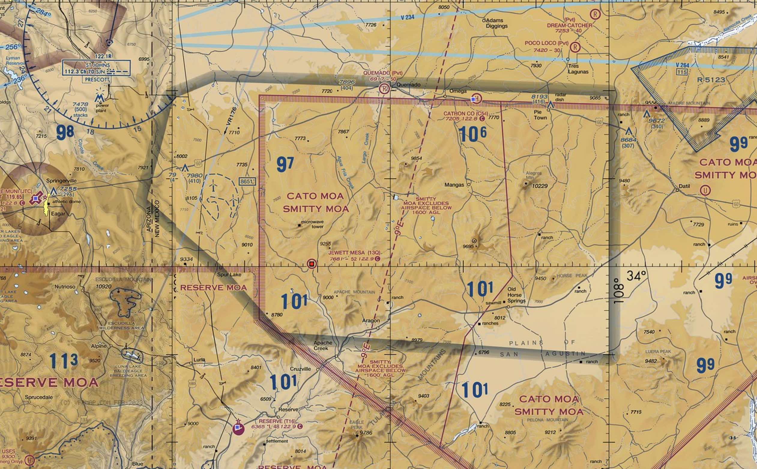
There are two left. Big bend national park in Texas and New Mexico near Cato MOA
-
$\begingroup$ @Stephen, examples? Scanning the continental US on skyvector, I only see those two. The areas mentioned in other answers are no longer G-to-145. There are some areas of higher G charted along the Mexican and Canadian borders, and some beginning a little ways out to sea, but the two Tim mentioned are the only ones I can find actually in the US. I don't even see any left in Alaska anymore. $\endgroup$ Commented Oct 15, 2022 at 4:32
-
$\begingroup$ @randomhead What the …!? There was a ton all over the Southwest and Alaska last time I looked, and I didn’t think it was that long ago. I stand corrected. $\endgroup$– StephenSCommented Oct 22, 2022 at 6:03
Here is another example jewett mesa. Inside this polygonal shape is class Golf extending up to 14500 MSL:
-
$\begingroup$ Looks like is has been chopped in half since the answer, making Jewett Mesa now 1200ft below class G $\endgroup$ Commented Jan 23 at 1:54
-
$\begingroup$ Search for Airport (C54) for to find the Smitty MOA on skyvector.com. skyvector.com/… $\endgroup$ Commented Mar 25 at 23:04
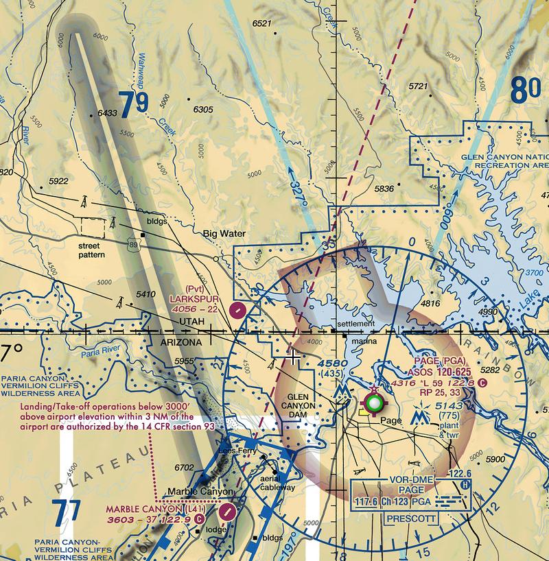
Look in the Big Bend Area of Texas. Large chunk of what your are looking for on the sectional chart in that area.


