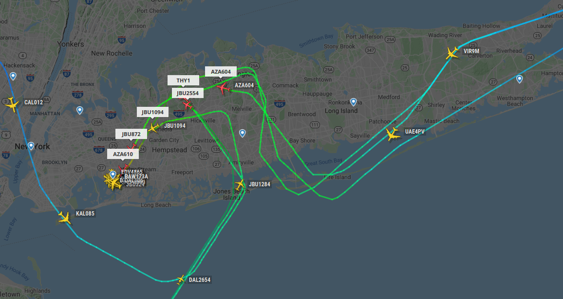
Every time I've flown into JFK Airport from the east I've noticed that the plane takes a weird zigzag path over Long Island. Why is this? Is it because of noise laws?
-
2$\begingroup$ Just a guess, but it's likely a combination of routes following existing navaids and fixes (which don't line up in straight lines) and keeping inbound JFK traffic away from Long Island Mac Arthur (ISP) traffic. $\endgroup$– GerryCommented Dec 4, 2019 at 16:47
-
$\begingroup$ @Gerry: Why does JFK traffic have to make way for ISP traffic, rather than the other way around? $\endgroup$– VikkiCommented Dec 4, 2019 at 22:06
-
3$\begingroup$ @Sean Because it's called the National Airspace SYSTEM. It's about optimizing everyone's use of the airspace. The airspace right around an airport is the most congested so it makes sense to keep aircraft not going to or from that airport out of the way. It goes both ways. If you're in northern PA headed for KISP, you're not going to get a straight flight through the NYC airspace. You have to avoid interfering with LGA, JFK, EWR, and TEB traffic. $\endgroup$– GerryCommented Dec 4, 2019 at 22:52
1 Answer
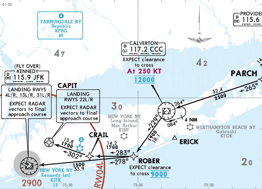
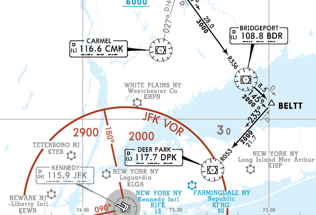
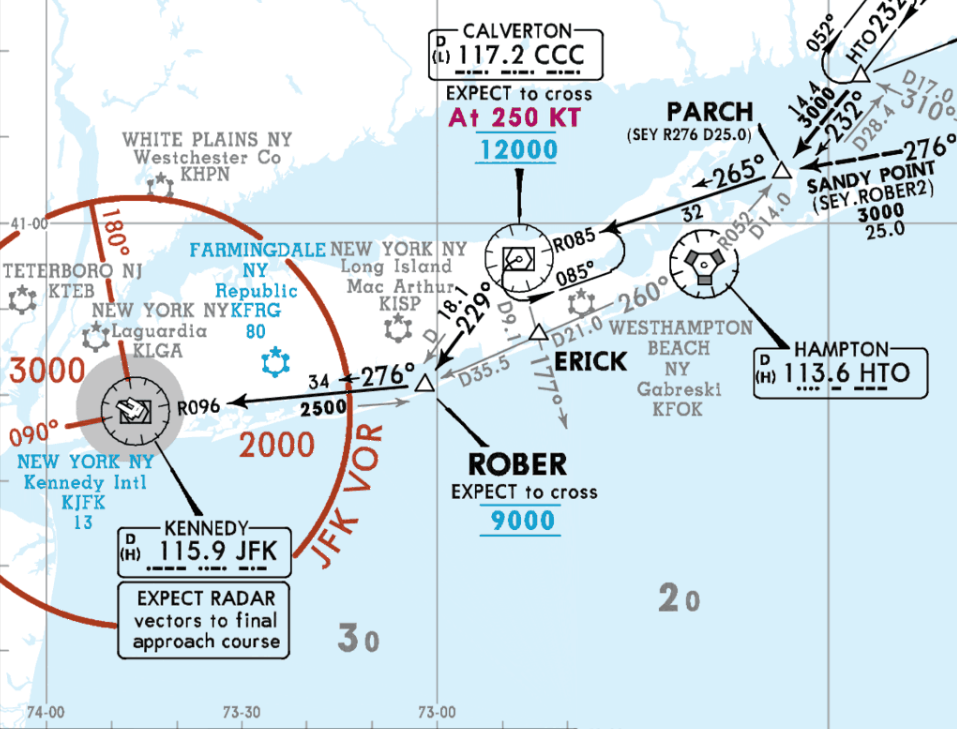
There are 3 STARs (Standard Terminal Arrival Routes) into JFK that cross over Long Island:
None of these have particularly pronounced zigzag patterns, so what you describe is probably not coming from the waypoints of the arrival procedure.
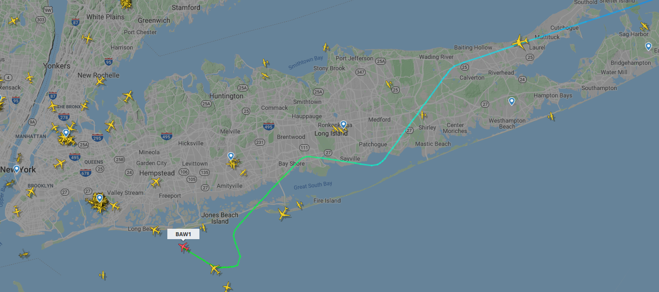
Looking at flightradar24.com, we can currently see BAW1 approaching JFK:
This already looks a bit more like a zigzag. It would seem they are arriving on the PARCH3 or ROBER2 until ROBER and then received radar vectors onto final approach for runway 31L/R. These vectors are typically given by ATC (Air Traffic Control) for spacing reasons.
When going back to yesterday evening using flightradar24's Playback feature, one finds much more pronounced turns over Long Island (thanks to ymb1 for suggesting this):
Here, aircraft are approaching runways 22L/R. You can see that there are also aircraft from the South and West joining the queue to land and ATC needs to make sure there is enough separation between the aircraft. The easiest way to achieve this is by instructing them to fly in a certain direction ("radar vectors") until there is enough space to fit them into the queue, which results in such a zigzag pattern.
Such turns can also be more localized than shown here. See e.g. Why did my LGA-ORD flight make an S-shaped turn round the time it was passing a storm?, where a flight into Chicago made an S-shaped turn during the descent, which would also feel like a zigzag. Such instructions can also be given to aircraft while they are still flying on the STAR over Long Island, especially when there is a lot of traffic during peak hours.
-
$\begingroup$ If I'm flying into JFK it's usually around 10 pm, if that matters. The entire approach is over land and it goes from top to bottom to top etc. $\endgroup$ Commented Dec 4, 2019 at 20:18
-
$\begingroup$ @MattSamuel That makes sense. You can see that all arrivals from the East fly over Calverton (North side) and then ROBER (South side). If runways 22L/R are in use, they have to fly back to the North side afterwards to join the final approach. I found a nice example of this from yesterday evening (I think around 11 PM, but looks exactly like what you describe). $\endgroup$ Commented Dec 4, 2019 at 20:45
-
$\begingroup$ The time might have been 11pm-12am. I just remember that it was a god awful hour with two very young children who usually go to sleep at 7 pm. $\endgroup$ Commented Dec 4, 2019 at 20:49
-
1$\begingroup$ @Sean: While seaborne navaids are a thing, having one there permanently for JFK doesn't make sense :) It seems you're asking why the STARs were designed that way, which is a different question, and it has to do with where the VORs were built, even in the RNAV case. Redesigning the whole thing because a plane can do without a VOR station is not ideal; minimal gradual changes are better than making the lives of ATC/pilots harder. $\endgroup$– user14897Commented Dec 4, 2019 at 22:23
-
1$\begingroup$ @Sean: I think this is relevant: What is the history and process of designing new waypoints and airways? I also mention a program for the NJ/NY/Philly area. $\endgroup$– user14897Commented Dec 4, 2019 at 22:41

