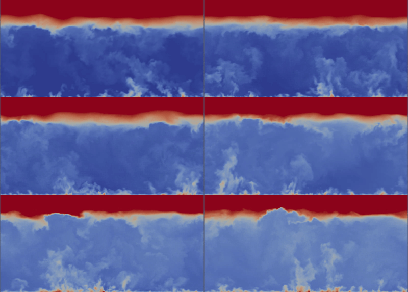
I made a short LES simulation

The color is thhe potential temperature and the scale span is 1.8 K between blue and red. There is a hot patch 100 m x 100 m in the middle. There is 0.1 K.m/s (~110 W/m^2) sensible heat flux elsewhere but 0.3 K.m/s (~330 W/m^2) in the that square. The wind speed is very low, only 1 m/s (~2 knots), still any significant long-term stationary plume is hardly visible. The BL height is about 1 km (900 m at the start, but the gif starts later). The case is completely dry for simplicity. With 30 fps it is 2 minutes of real time per every second of the animation.
Even after 1 hour averaging, the increased temperature is only visible quite localized close to the ground and the vertical velocity field is just determined by those large convective cells, any rising current from the patch cannot be identified in the 1-hour-averaged vertical velocity field at all. Note that the closest point is 5 m from the ground so we do not see the extremely hot layer very close to the surface, but it is properly parametrized.
The 100 m x 100 m ("football field") patch was simply too small to have a significant effect. It will help you in the surface layer, and may get you from the winch altitude to some bigger thermals, but it certainly won't get you to the inversion. Or it will be good for soaring birds.
Those sensible heat fluxes I applied are not low but rather typical. Remember that normally a large part of the total heat flux is taken by the latent heat flux.
Firstly, please note that surface heterogeneity is not necessary for thermal convection. Convection happens because of the surface heat flux and thermodynamic instabilities, not because of heterogeneities. Heterogeneities may introduce secondary circulation and various currents.
According to the simplemost particle method, an air particle will raise roughly to the height where its temperature will equal the temperature of the surrounding atmosphere. Your 5.4 K per 1000 ft corresponds roughly to the dry adiabatic lapse rate, that means that the potential temperature is constant. That happens in the mixed part of the convective boundary layer and after the capping inversion with some step rise it will then increase with some gradient. If you heat your thermal say 1 K above the mixed layer potential temperature, then it will rise until it equalizes with the surroundings. If your pot. t. gradient above the mixed layer is 1 K / 100 m, the inversion is weak, it may rise roughly another 100 m. 1 K is already a lot. It won't get you kilometers above the capping inversion. Only large convective clouds can do that.
Even regular thermals do enter the stably stratified layer above the capping inversion and cause entrainment. This is the entrainment layer.
The real thermodynamic temperature is less convenient because it decreases in the mixed layer (9.8 K per 1 km) and then may either increase or decrease above the capping inversion (end still be stably stratified, the sign is not that important).

