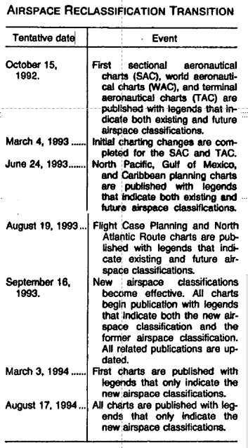
When did the thin dashed magenta line, currently used to illustrate Class-E-to-surface airspace, first appear on the legend of US VFR sectional charts? I'd like to narrow down the date as precisely as possible. Currently I'm aware that this marking DID appear on the legend of a sectional chart (Hawaiian Islands) effective November 12 1992, and did NOT appear on the legend of a sectional chart (Bethel Alaska) effective August 20 1992. Please post the "effective date" of any US VFR sectional chart that you are aware of before November 12 1992 in which the thin dashed magenta line does appear on the legend, or the "effective date" of any US VFR sectional chart that you aware of after August 20 1992 in which the thin magenta line does not appear on the legend.
Note that on the legend of the November 12 1992 chart, the thin dashed magenta line is identified not as depicting "Class E airspace", but rather as depicting "Control Zone at airport without control tower and Control Zone extension without communications requirement". The term "Class E" didn't show up on legend of US VFR sectional charts until 1993.

