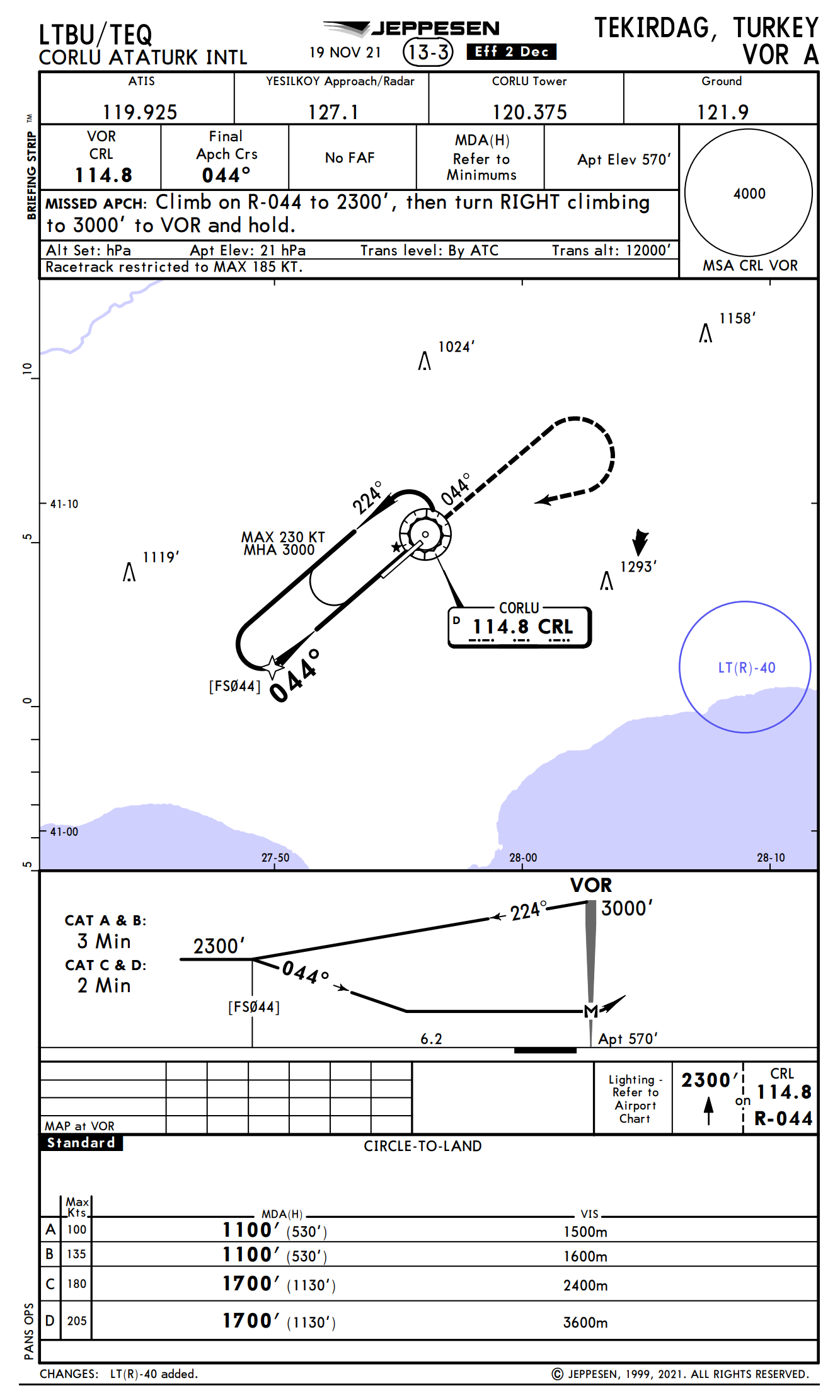
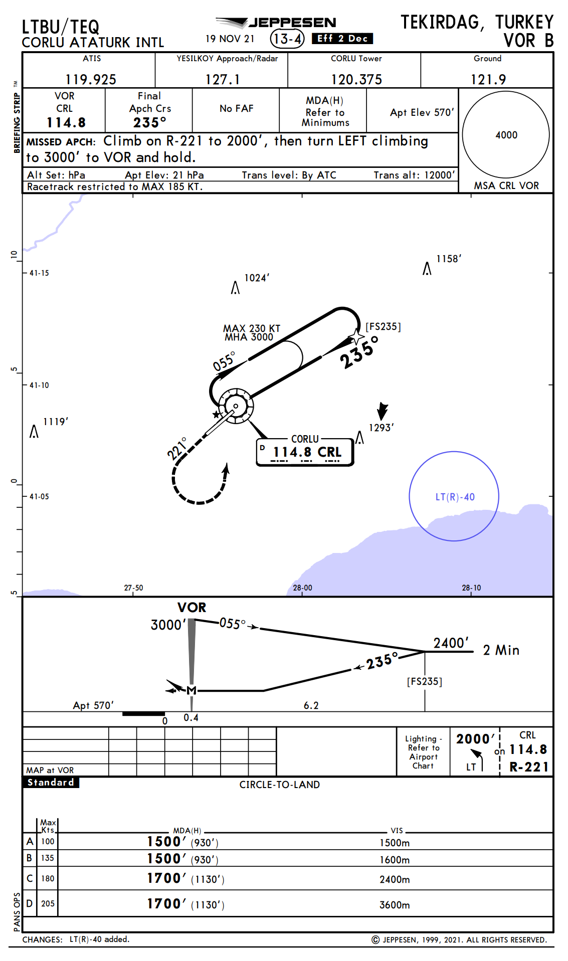
Although this approach is suitable for straight-in landing in every sense, why are circle-to-land minimums given? There are no obstructions, the gradient in the descent path is not steep and the approach course is the same as the runway course (044°). How and why are the minimum values on such VOR charts A, B, and C always classified as "circle-to-land"? Why can't it be classified as a straight-in landing? I thought it might be because there is no DME, but there are also charts of airports that use DME with VOR A. There are other charts that use straight-in landing minimums for this airport, yes I know, but I do not believe that charts were produced just to be able to call the minimums of such an approach as circle-to-land minimums.
1 Answer
For the VOR-A approach, probably because the MAP (at the VOR) is beyond the end of the runway.
If you were flying the approach and did not see the runway until you were part way down it at the MDA (before reaching the MAP) you might be too high to make a straight-in landing and would probably have to circle.
However, if you saw the runway early enough (well before the MAP) to allow you to make a straight-in landing you would not have to circle.
For the VOR-B approach, the MAP is 0.4 miles from the threshold. For Cat A/B and Cat C/D aircraft the descent gradient, if you saw the runway exactly at the MAP (0.4 miles from the threshold), is fairly steep and perhaps steeper than the approach design criteria would allow for a straight-in landing under the rules used in Turkey for approach design.
-
$\begingroup$ Yes, perhaps, but we will never fully understand the exact reason for this. So, what could be the reason why the chart I added with the revision (VOR B) is like this? Missed approach point arrives before the runway is crossed. However, while straight-in landing minimums can be used, especially circle-to-land minimums are used. $\endgroup$– pilot162Commented Mar 1, 2023 at 18:41
-
$\begingroup$ Addition: The final approach course is within limits even if it is not aligned with the runway course. $\endgroup$– pilot162Commented Mar 1, 2023 at 18:43
-
1$\begingroup$ For the VOR-B, the MAP is 0.4 miles from the threshold. For Cat A/B airplanes and Cat C/D the descent gradient, if you saw the runway exactly at the MAP (0.4 miles from the threshold), is fairly steep and perhaps steeper than the approach criteria would allow under the rules used in Turkey for approach design. $\endgroup$– user22445Commented Mar 1, 2023 at 19:05
-
$\begingroup$ Yes, I guess I overlooked that. Thanks for the explanation! $\endgroup$– pilot162Commented Mar 1, 2023 at 19:11
-
$\begingroup$ Isn't it more the lack of DME and therefore not being able to even approximate a glide slope that is the problem here? The position of MAP is just a consequence of that as the only point you know how far along the track you are is right over the VOR. $\endgroup$ Commented Mar 1, 2023 at 21:54


