Yes, it's the same. An airport consists of one or several runways, one or several parking areas (aprons) and a number of taxiways connecting them. All runways and taxiways are uniquely named.
When taxiing around the airport - be it from runway to parking, or vice versa, or between parking areas, hangars etc. - ATC instructs the pilot of the exact route to follow by specifying the taxiway names in order. ATC can also instruct the pilot to stop and wait at a certain position, or to follow or give way to specific other aircraft. Some airports, in addition to named taxiways, have named holding points around the airport which can be used to specify where the aircraft should stop and await further instructions.
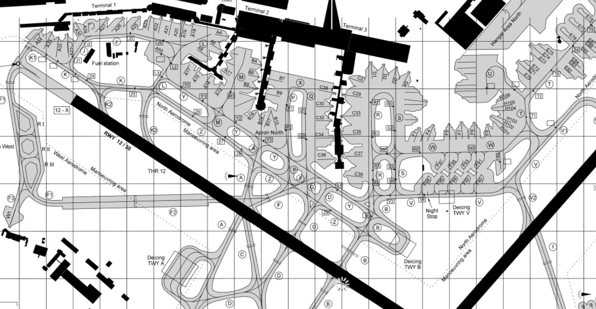
Pilots who are not familiar with the airport will have no problem following instructions, since they all have a ground chart (essentially a street map) of the airport layout, with all the taxiway and runway names.

Example of aerodrome chart - Copenhagen Airport, reproduced from AIP Denmark
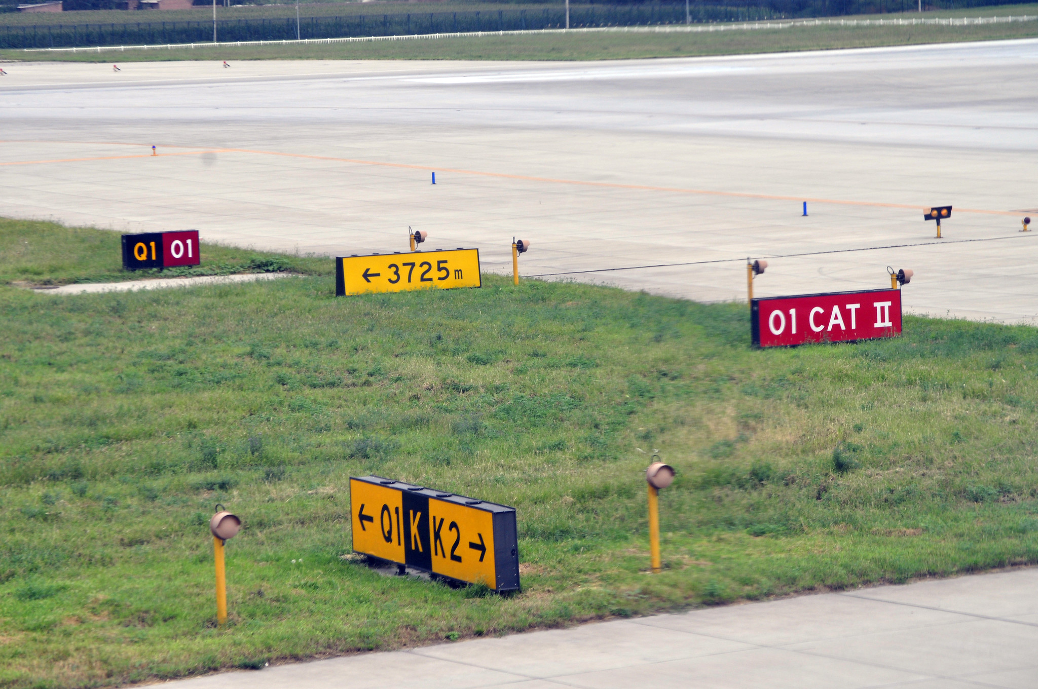
Some modern airliners even have a moving map which shows the aircraft GPS position directly on a digital airport map in the cockpit. In addition, signs are posted at all taxiway and runway intersections, showing the name of the current and any adjacent taxiways and runways.

Taxiway signs
In extreme cases, ATC can make use of turn-by-turn instructions (progressive taxi), but that is very rarely needed. Follow-me/marshall vehicles are also available, but those are usually not to help the pilot find the way, but rather to provide an extra set of eyes when taxiing very big aircraft, to ensure they stay on the pavement during a narrow turn/tight gap etc.


