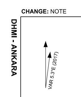
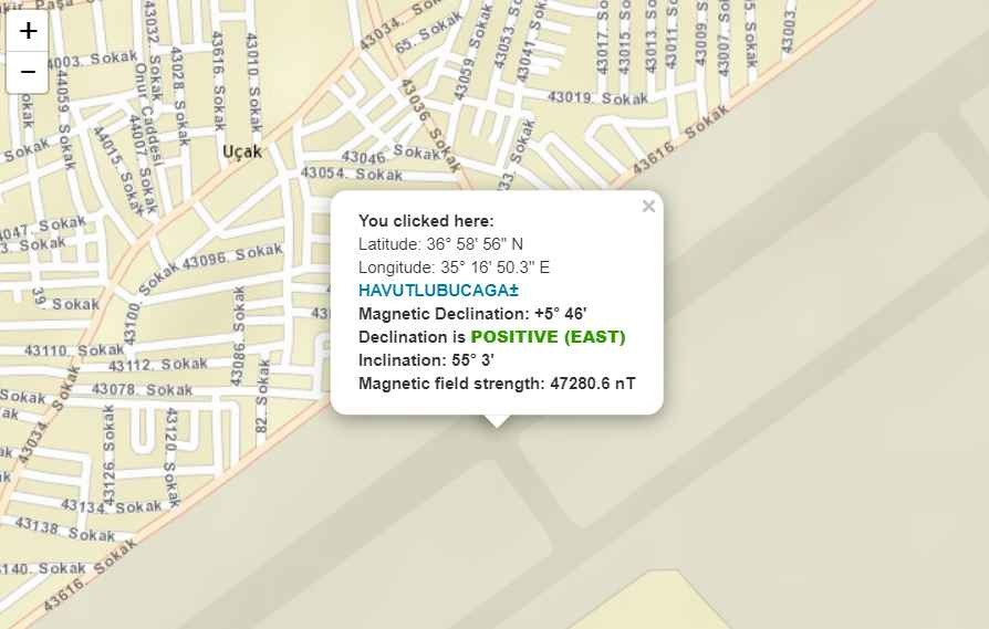
Why is the magnetic variation value from 1999, although the AIP Charts in my country are up to date? In all of the chart examples I shared below, the variation value is 3.2°E and belongs to 1999. According to my research, the current variation value of ADANA LTAF airport is 5° 46' E. The year the charts are published is 2021. In addition, the variation value of 2017, 3.5°E, is shared on the airport chart. Why are all these values out of date and not fixed? Why is such a way of sharing followed in the charts? Any ideas?
Why is the magnetic variation value from 1999, although the AIP Charts in my country are up to date?
1 Answer
$\begingroup$
$\endgroup$
4
Because the magnetic declination in a given area changes slowly over time, as little as 2–2.5 degrees every hundred years or so, or by 1 degree every three years in locations closer to the poles. Depends what part of the world the map covers. Not many airport facilities close to the poles.
-
2$\begingroup$ The OP already knows that magnetic declination is changing with time. The question was about why the values on the charts are so old. $\endgroup$ Commented Sep 6, 2023 at 17:12
-
1$\begingroup$ @Bianfable Read my answer again. The reason is because the declinations change very slowly over time. Values will not be updated for small fractions in changes. $\endgroup$ Commented Sep 6, 2023 at 17:17
-
$\begingroup$ First of all, thank you for your answer. I can understand why it's not on every amendment chart because it changes so slowly. But when the new magnetic deviation is 5° 46' E, why are they still sharing the 1999 value of 3.2°E instead of changing it in the newly published chart? There is not a small difference, but a big difference of almost 2.5 degrees. Isn't this ridiculous? Because we have new data and they prefer not to share it in the current chart (2021) (?). Interesting.. $\endgroup$– pilot162Commented Sep 8, 2023 at 7:48
-
$\begingroup$ I suspect it's because few people are doing their navigation with methods that require taking deviations into account, and instead rely on GPS and other means of navigation data. $\endgroup$ Commented Sep 9, 2023 at 16:48


