Added flight track to OpenStreetMap view
Source Link
Steve Pemberton
  • 1.3k
  • 1
  • 5
  • 15

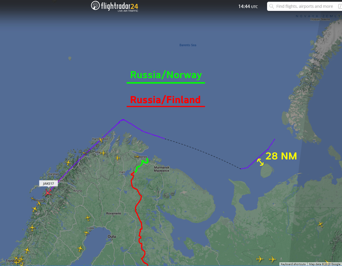
Are you possibly thinking that the landmass that the aircraft is flying over is Russian territory? It is actually flying over Norway. In the image below I colored in green the border between Russia and Norway, and in red the border between Russia and Finland.
Russia Norway border

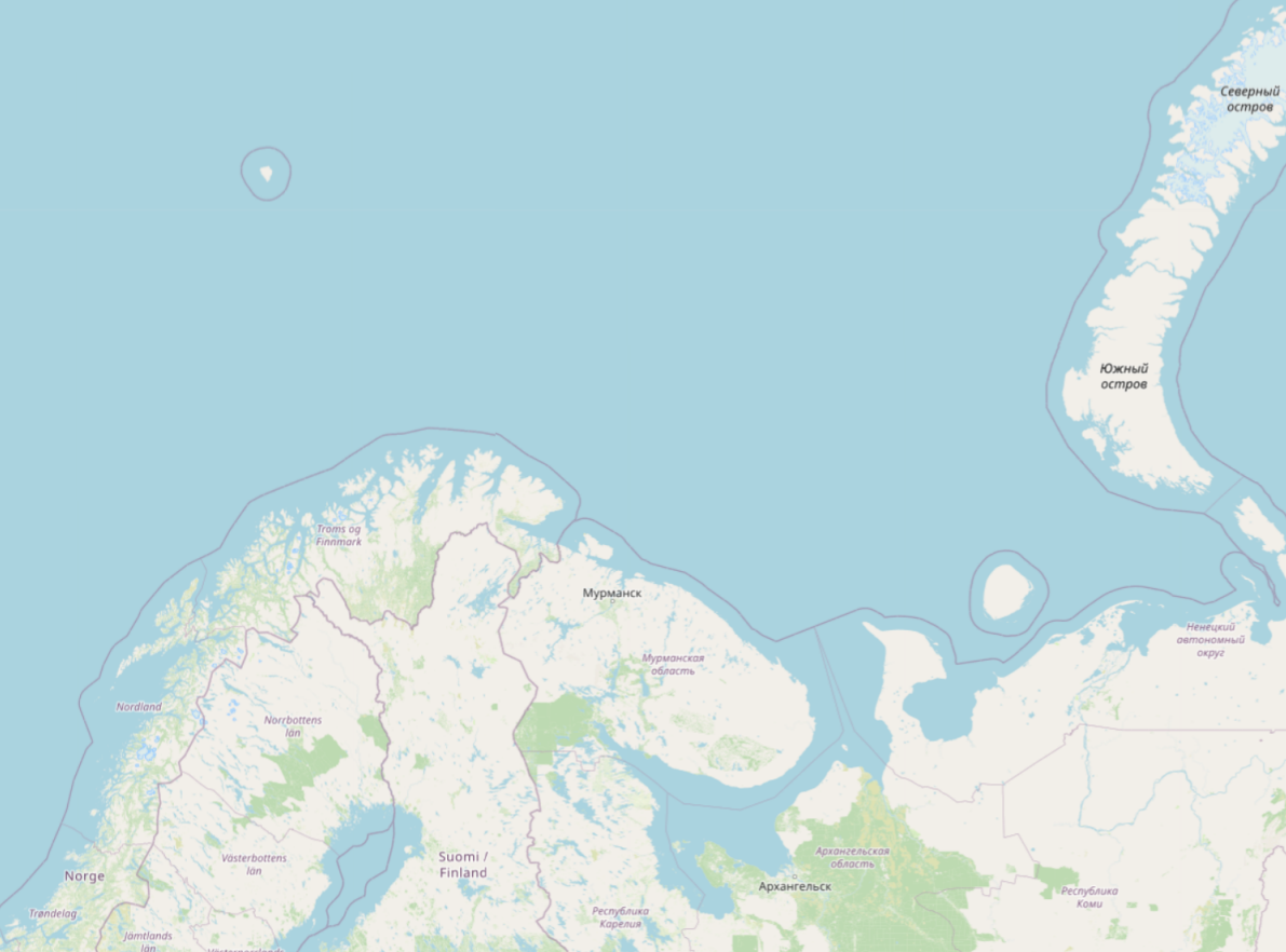
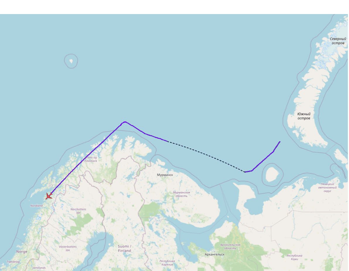
The closest that it got to Russian landmass appears to be about 28 nautical miles (32 miles, 52 km). As mentioned in another answer to your question the limit is 12 nautical miles. And as mentioned in a comment by @Bianfable, OpenStreetMap shows this boundary.

Openstreetmaps Openstreetmaps

Are you possibly thinking that the landmass that the aircraft is flying over is Russian territory? It is actually flying over Norway. In the image below I colored in green the border between Russia and Norway, and in red the border between Russia and Finland.

Russia Norway border

The closest that it got to Russian landmass appears to be about 28 nautical miles (32 miles, 52 km). As mentioned in another answer to your question the limit is 12 nautical miles. And as mentioned in a comment by @Bianfable, OpenStreetMap shows this boundary.
Openstreetmaps

Are you possibly thinking that the landmass that the aircraft is flying over is Russian territory? It is actually flying over Norway. In the image below I colored in green the border between Russia and Norway, and in red the border between Russia and Finland.

Russia Norway border

The closest that it got to Russian landmass appears to be about 28 nautical miles (32 miles, 52 km). As mentioned in another answer to your question the limit is 12 nautical miles. And as mentioned in a comment by @Bianfable, OpenStreetMap shows this boundary. Openstreetmaps
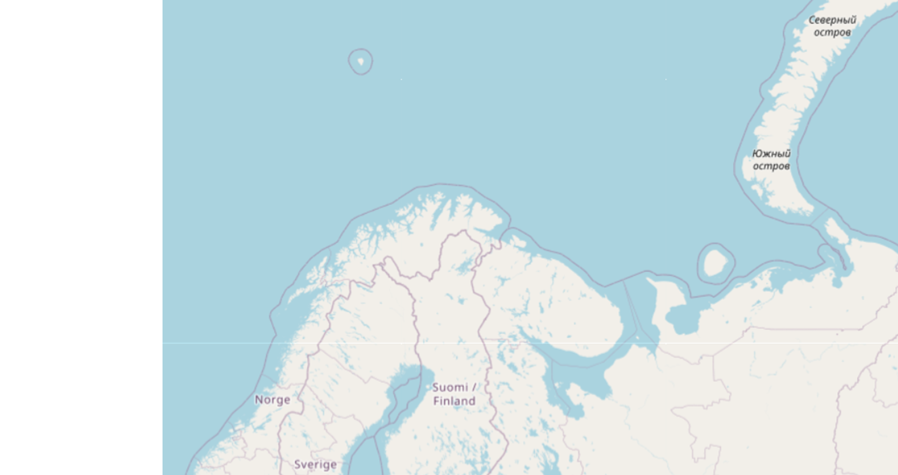
Adjust the size of the second map to match the first map
Source Link
Steve Pemberton
  • 1.3k
  • 1
  • 5
  • 15

Are you possibly thinking that the landmass that the aircraft is flying over is Russian territory? It is actually flying over Norway. In the image below I colored in green the border between Russia and Norway, and in red the border between Russia and Finland.

Russia Norway border

The closest that it got to Russian landmass appears to be about 28 nautical miles (32 miles, 52 km).

Russia Norway border

As mentioned in another answer to your question the limit is 12 nautical miles. And as mentioned in a comment by @Bianfable, OpenStreetMap shows this boundary.
OpenstreetmapsOpenstreetmaps

Are you possibly thinking that the landmass that the aircraft is flying over is Russian territory? It is actually flying over Norway. In the image below I colored in green the border between Russia and Norway, and in red the border between Russia and Finland.

The closest that it got to Russian landmass appears to be about 28 nautical miles (32 miles, 52 km).

Russia Norway border

As mentioned in another answer to your question the limit is 12 nautical miles. And as mentioned in a comment by @Bianfable, OpenStreetMap shows this boundary.

Openstreetmaps

Are you possibly thinking that the landmass that the aircraft is flying over is Russian territory? It is actually flying over Norway. In the image below I colored in green the border between Russia and Norway, and in red the border between Russia and Finland.

Russia Norway border

The closest that it got to Russian landmass appears to be about 28 nautical miles (32 miles, 52 km). As mentioned in another answer to your question the limit is 12 nautical miles. And as mentioned in a comment by @Bianfable, OpenStreetMap shows this boundary.

Openstreetmaps

Changed border colors for better visibility
Source Link
Steve Pemberton
  • 1.3k
  • 1
  • 5
  • 15

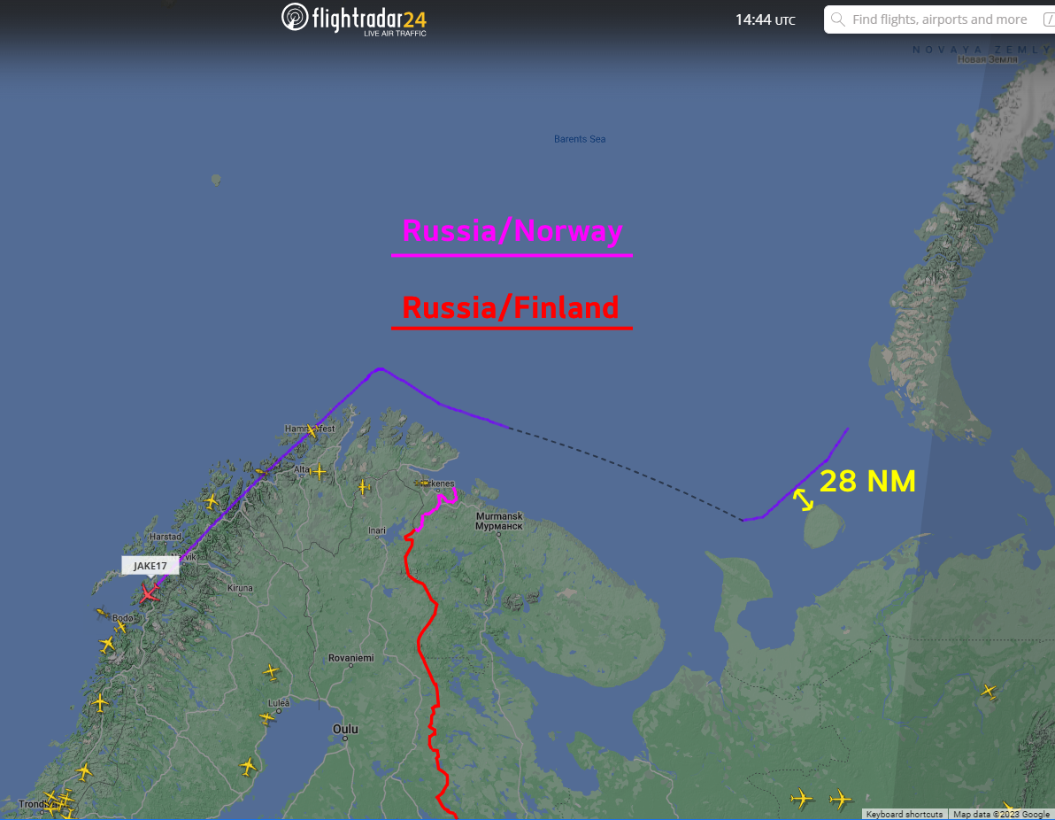
Are you possibly thinking that the landmass that the aircraft is flying over is Russian territory? It is actually flying over Norway. In the image below I colored in magentagreen the border between Russia and Norway, and in red the border between Russia and Finland.

The closest that it got to Russian landmass appears to be about 28 nautical miles (32 miles, 52 km).

Russia Norway border Russia Norway border

As mentioned in another answer to your question the limit is 12 nautical miles. And as mentioned in a comment by @Bianfableb@Bianfable, OpenStreetMap shows this boundary.

Openstreetmaps

Are you possibly thinking that the landmass that the aircraft is flying over is Russian territory? It is actually flying over Norway. In the image below I colored in magenta the border between Russia and Norway, and in red the border between Russia and Finland.

The closest that it got to Russian landmass appears to be about 28 nautical miles (32 miles, 52 km).

Russia Norway border

As mentioned in another answer to your question the limit is 12 nautical miles. And as mentioned in a comment by @Bianfableb OpenStreetMap shows this boundary.

Openstreetmaps

Are you possibly thinking that the landmass that the aircraft is flying over is Russian territory? It is actually flying over Norway. In the image below I colored in green the border between Russia and Norway, and in red the border between Russia and Finland.

The closest that it got to Russian landmass appears to be about 28 nautical miles (32 miles, 52 km).

Russia Norway border

As mentioned in another answer to your question the limit is 12 nautical miles. And as mentioned in a comment by @Bianfable, OpenStreetMap shows this boundary.

Openstreetmaps

Source Link
Steve Pemberton
  • 1.3k
  • 1
  • 5
  • 15
Loading