14
$\begingroup$

The case of the lost Malaysian Airlines plane is tragic for all those involved.

In the case of such a plane lost over the ocean, hypothetically (and described very simplistically), it would seem that the fastest way to search for wreckage would be:

  • to define an area to be searched
  • wait for the latest satellite images for that area at high-resolution to be available (given appropriate positioning and programming of the satellites)
  • then search the captured imagery for deviations from ocean blue

Presumably this could be done reasonably quickly by a computer, and that satellite imagery is taken after a suspected crash, and exceptions (e.g. spots of white amongst the blue) are able to be verified by a human.

Does such a system exist? Are imaging satellites able to be configured to take such imagery on demand over a large area? And do such batch-image processing systems exist for this purpose?

$\endgroup$

3 Answers 3

11
$\begingroup$

Update: Satellites were eventually used in the search for MA370, see this article.


This question might be better answered by the folks at space exploration but here's a shot:

  • Oil slicks are not uncommon at sea, so finding one from the aircraft is not too easy.

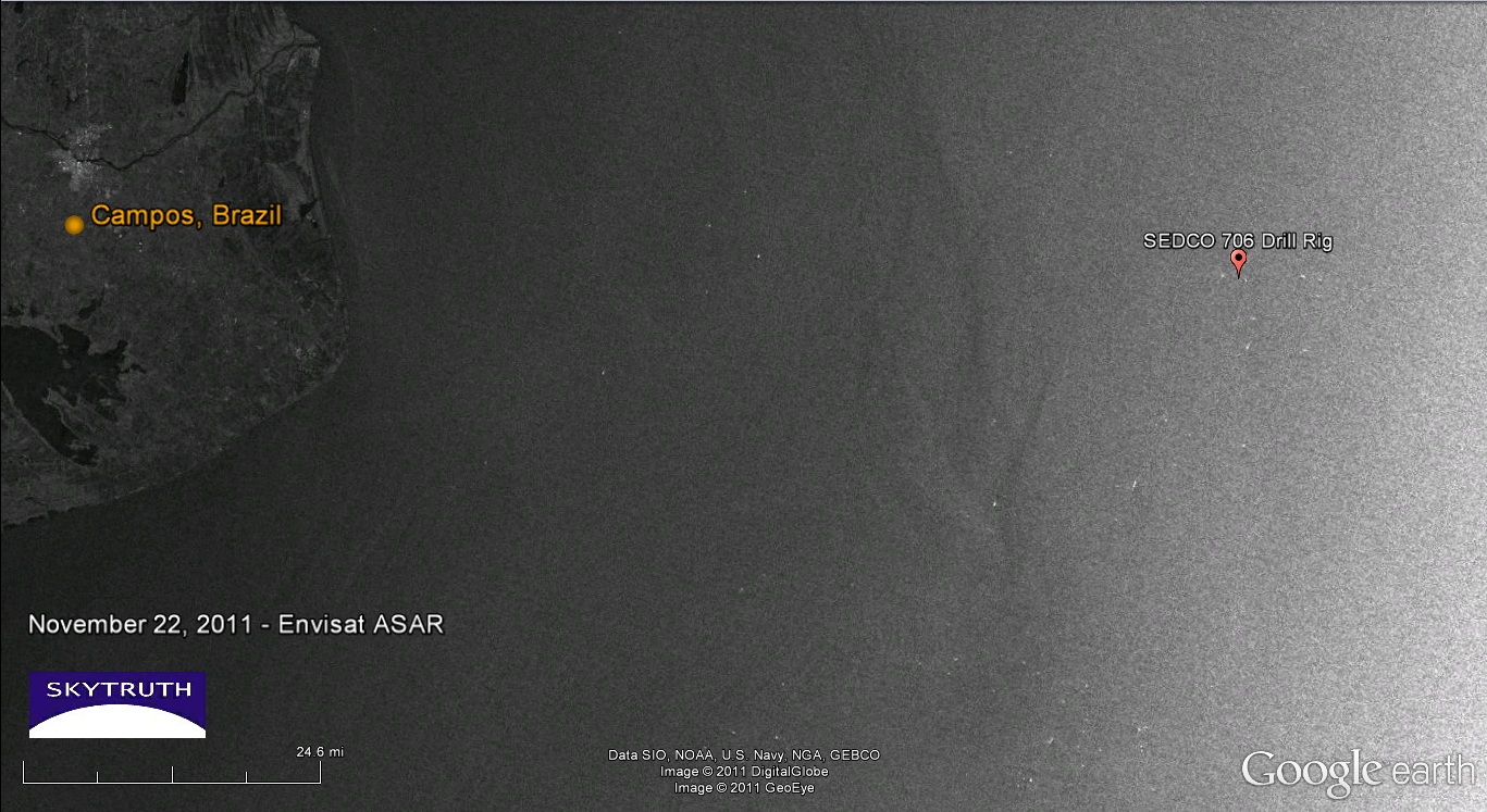
  • It's an incredibly large area pulling a lot of processing power. You're going to need pretty good resolution imagery over several square kilometers and then run image recognition on it. Look at this image which has a scale of 25 miles which is still a fraction of what you would need to get an idea:

sat

  • The fragments you're looking for are very small in regards to waves. I suspect depending on where you are there's a large amount of noise from other rubbish which is hard to filter out, such as a white plastic sheet to a door. You might even go confusing big aircraft parts to other white boats. Yes, you can continue the search but it takes time to go through all of these and dismiss them.

  • A lot of volunteers searched for Steve Fossett when he went missing, and there was some attempts to locate him by satellite imagery from google maps, which was not successful.

  • Aircraft, while not fast, can be over the side within a few hours, while I think you have to wait until the satellites have caught all the imagery you would like.

While I think it could be done as you say, you would need to develop software and I don't think the market for it exists, but that's just my guess. Reading up it appears that satellites are used against drug cartels along the USA-Mexico border and against illegal immigrants elsewhere in the world.

$\endgroup$
5
  • 3
    $\begingroup$ Note that, in general, searching Google Maps won't help because the "satellite" (actually, mostly aerial) imagery is often several years out of date. In the Fossett case, Google obtained fresh imagery from Digital Globe $\endgroup$ Commented Mar 10, 2014 at 17:51
  • $\begingroup$ My point with the satellites was that for government satellites, compared with the cost of sending government-paid search/recovery efforts, especially with military resources, there might be a cost advantage to temporarily re-purposing satellites to capture data over a given area. The data obtained by Google is only updated infrequently, but satellite data can be updated within one or two days in some cases. $\endgroup$
    – CJBS
    Commented Mar 10, 2014 at 18:55
  • $\begingroup$ The point about wave/wash colour in comparison to mostly white aircraft parts is a good one. $\endgroup$
    – CJBS
    Commented Mar 10, 2014 at 19:07
  • 1
    $\begingroup$ Another attempt to use satellite imagery in the search. $\endgroup$ Commented Mar 11, 2014 at 9:52
  • 2
    $\begingroup$ @CJBS the main problem with repositioning satellites for spot use like this is that they only have a limited amount of fuel for doing that, and that's needed to keep the satellite in a stable orbit as well. Thus repositioning it for the purpose of taking a few snapshots of a patch of open ocean is extremely costly, it reduces the life of that satellite by potentially years, which given the construction and launch cost means a price tag of tens of millions of dollars. Cheaper to fly out a P3 or other patrol aircraft. $\endgroup$
    – jwenting
    Commented Mar 13, 2014 at 8:59
9
$\begingroup$

Massive area, large search interval, no complete coverage of the entire area, especially no permanent coverage of the entire area, weather, limited computer power.
All those factors, each on their own, would make the problem massive. Taken together they make it insurmountable.
We're talking an area of several million square kilometers that needs to be searched, at a resolution of a few square meters, over an interval of several hours.

Not only is there no 24/7 photographic coverage at that resolution available of any spot on the planet, it certainly won't exist of a stretch of open ocean in a backwater of geopolitical interest (it MIGHT exist just around the time of a drone strike on a Taliban compound for example, over an area of a few hundred meter around that compound, for maybe 10 minutes prior to 10 minutes past, but that data would be highly classified for obvious reasons and utterly useless unless an airliner crashed right on top of that compound during that small window).

Manfred hints that satellite coverage is used against drugs and human trafficking and it may be. But it can't detect individual human beings. It CAN potentially detect patterns, like finding paths through brushland that from the ground can't be easily seen but from the air show up. And in case of anti-trafficking use, it mainly is used to surveil known or suspected points of departure, say an airfield in Colombia known to be used by drugs smugglers, and alert law enforcement agencies of a possible inbound aircraft which can then be tracked using other means (like AWACS) and intercepted. Same with boats. But it's not real time, it's photos taken at several hour intervals of known "points of interest".

We simply lack the resolution to see something the size of a human being (or a floating piece of aircraft debris like a toilet seat or life jacket) from orbit.

Oil slicks, which tend to spread out a lot, can be observed and investigators sent to the area. This is used in coastal regions to find and fine ships that illegally dump oil from their balast tanks. But again, there's no permanent coverage and certainly not over open ocean. Maybe some country with the capability can redirect one of its satellites after the suspected crash, and hopefully when it gets there it's not too late (dispersal is rapid) AND the weather is clear AND there's daylight AND everything else falls into place.

No, the best hope is narrowing down the area based on last radio or radar reporting position, and do an area search from there. And if you get real lucky you get a responder in the FDR or CVR to give you a beep, or an emergency beacon in a life raft that got shook loose and turned itself. Other than that, fingers crossed that someone with a pair of binoculars spots something floating out there before it's all sunk to the bottom.

$\endgroup$
3
  • $\begingroup$ I don't think satellites can be used against drug trafficking. They are used against drug production, because coca plantations can be recognized by colour on a multi-spectral satellite image. Plus they can show paths even (to an extent) under tree cover, giving away locations of hidden facilities. They can show jungle airports as they are larger deforested patches, but they can't catch a suspicious plane. Radar or AWACS is needed for that. $\endgroup$
    – Jan Hudec
    Commented Mar 10, 2014 at 18:08
  • $\begingroup$ I would have thought that, even for an aircraft that collides with the ocean in-tact, wouldn't a signal have been transmitted from its 406 MHz ELT following the impact? Presumably at least some of the wreckage floats for a brief period before sinking. 406 MHz ELTs transmit to satellites. Of course this is assuming that the tail of the plane doesn't go underwater immediately and continue to sink without a chance to transmit a clear signal first. $\endgroup$
    – CJBS
    Commented Mar 10, 2014 at 19:05
  • $\begingroup$ @JanHudec they're used to help in interdicting large shipments through surveillance of known shipping routes. They can't of course detect whether an aircraft has drugs in it, but they can detect an unscheduled departure for example by IR imaging of airfields. $\endgroup$
    – jwenting
    Commented Mar 13, 2014 at 8:56
3
$\begingroup$

Digital Globe, a satellite imaging company (who provide a lot of the data Google uses), has done this for the MH370 flight using a platform called Tomnod, which is currently directing all users straight to the search page. The images they're showing now were taken on 3/9, so apparently they are able to re-task their satellites fairly quickly.

More info on how to use this is available at How To Use Tomnod To Find MH370.

Something similar was done using Amazon Mechanical Turk during the search for Jim Gray.

$\endgroup$

You must log in to answer this question.

Not the answer you're looking for? Browse other questions tagged .