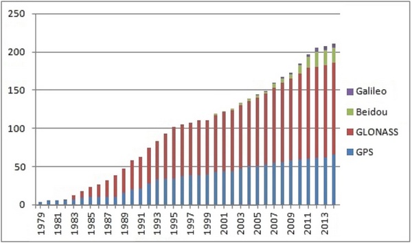
GNSS is a global satellite navigation system. GPS is the US GNSS.
A Global Satellite Navigation System (GNSS) is a system that uses satellites to provide autonomous geo-spatial positioning. It allows small electronic receivers to determine their location (longitude, latitude, and altitude/elevation) to high precision (within a few metres) using time signals transmitted along a line of sight by radio from satellites (Wikipedia).
GPS is the US GNSS. Other GNSS are used or under construction:
- GLONASS (ex-USSR countries)
- Galileo (Europe)
- BeiDou-2 (China)

