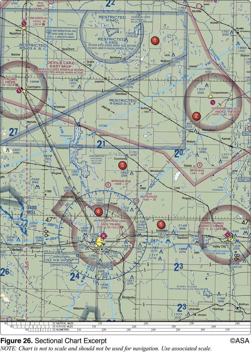
(Refer to Figure 26, area 5.) The airspace overlying and within 5 miles of Barnes County Airport is
A. Class D airspace from the surface to the floor of the overlying Class E airspace. ❌B.Class E airspace from the surface to 1,200 feet MSL. C.Class G airspace from the surface to 700 feet AGL. (this is correct)
"The Barnes County Airport is depicted inside the magenta shading, which is controlled airspace from 700 feet AGL up to but not including 18,000 feet. Therefore, the airspace below 700 feet AGL is Class G."
Studying for my private pilot exam, airspaces on the charts are a little confusing for me right now. The Magenta shading on the legend of sectional charts is specifically what is confusing me here. Why is the answer option C instead of option B? The two magenta shaded lines on the sectional charts both indicate class E, but one refers to Class G and the other does not. The explanations underneath them don't really make sense to me.
Thank you in advance to all the friendly folks who help me answer this.
