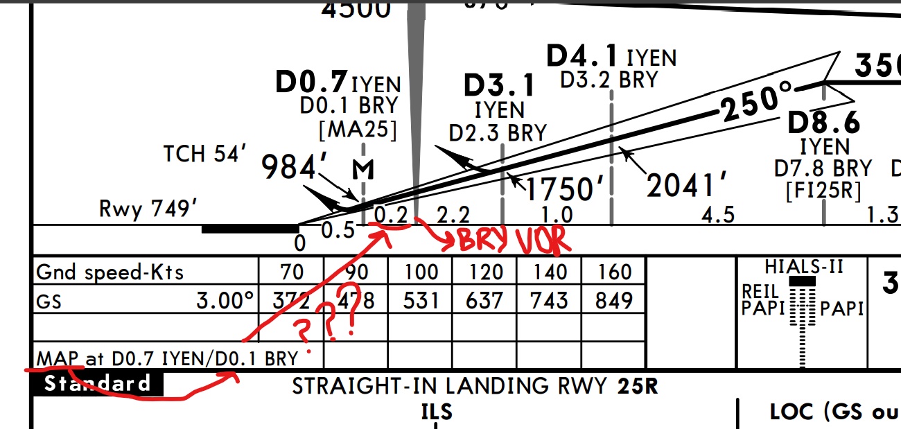
Why is the distance between BRY VOR and missed approach point 0.2 DME in the plan view, while it is specified as 0.1 DME below? If we consider that the localizer is 0.2 DME ahead of the runway threshold, the IYEN D0.7 information is correct. But in the plan view, the missed approach point seems 0.2 DME away from BRY VOR, not 0.1. Why is this difference due? I showed it with red marks in the picture. Also, this picture is from the ILS Z or LOC Z Rwy 25R Jeppesen chart of LTBR airport page 11-1.
1 Answer
This might be a mistake in the chart.
The Introduction to Jeppesen Navigation Charts defines the number between two navaids/fixes as follows:
10 — Nautical Mile (NM) distance between two navaids and or fixes.
I looked up the exact coordinates of the relevant fixes in my AIRAC 2210 database:
| Name | Latitude | Longitude |
|---|---|---|
| BRY (YENISEHIR VOR/DME) | 40.262527778 | 29.594027778 |
| BRY (YENISEHIR NDB) | 40.262527778 | 29.594027778 |
| MA25 | 40.261908333 | 29.591111111 |
| MA25R | 40.271713889 | 29.635888889 |
As you can see, the VOR/DME and NDB are co-located. The MA25R point is not part of ILS or LOC approach (it is used on the VOR Z approach). If you calculate the distance from the VOR to the MA25 fix, which is the missed approach point for the LOC approach, you get:
$$ \text{distance}(\text{BRY} \rightarrow \text{MA25}) \approx 0.1387 \, \text{NM} $$
So it should really say 0.1 there. Just for reference, the distance to MA25R is close to 0.2:
$$ \text{distance}(\text{BRY} \rightarrow \text{MA25R}) \approx 1.9950 \, \text{NM} $$
But this is in the other direction of the VOR.
In general, the DME distance can be larger than the coordinate distance because the DME shows slant range. If you look to the right of the VOR on your chart, you see a distance of 2.2 NM to a point at DME 2.3 to BRY. This could be due to slant range.
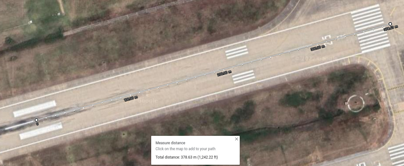
The distance to the runway threshold of 0.5 NM is also consistent with DME 0.7 to the ILS DME, if that DME is located near the aiming point, which is about 380 m (~0.21 NM) away from the threshold:
-
1$\begingroup$ @757toga But how can the slant range be less than the lateral distance? $\endgroup$ Commented Oct 12, 2022 at 13:59
-
$\begingroup$ Agree with @Bianfable -- slant range being the discrepancy would cause the numbers to mismatch in the other direction... the slant range (DME reading) should be larger than the lateral distance, not smaller. $\endgroup$– Ralph J ♦Commented Oct 12, 2022 at 14:08
-
1$\begingroup$ Unless it's a matter of how rounding is handled... when the exact lateral distance is 0.13 NM, which becomes some slant range, they may round that down so that the pilot starts the missed approach early rather than late. But to make all the lateral distances sum up correctly, perhaps the designer had a reason to round the 0.13 up to 0.2 instead of the usual convention. Or it's simply an error. $\endgroup$– Ralph J ♦Commented Oct 12, 2022 at 14:12
-
$\begingroup$ Many thanks to everyone for their valuable replies and comments. I will assume that the DME values in the Approach profile are the slant range and the distance given in the table below is the lateral distance. But I will not forget the possibility of inaccuracy or rounding calculation. $\endgroup$– pilot162Commented Oct 12, 2022 at 17:20


