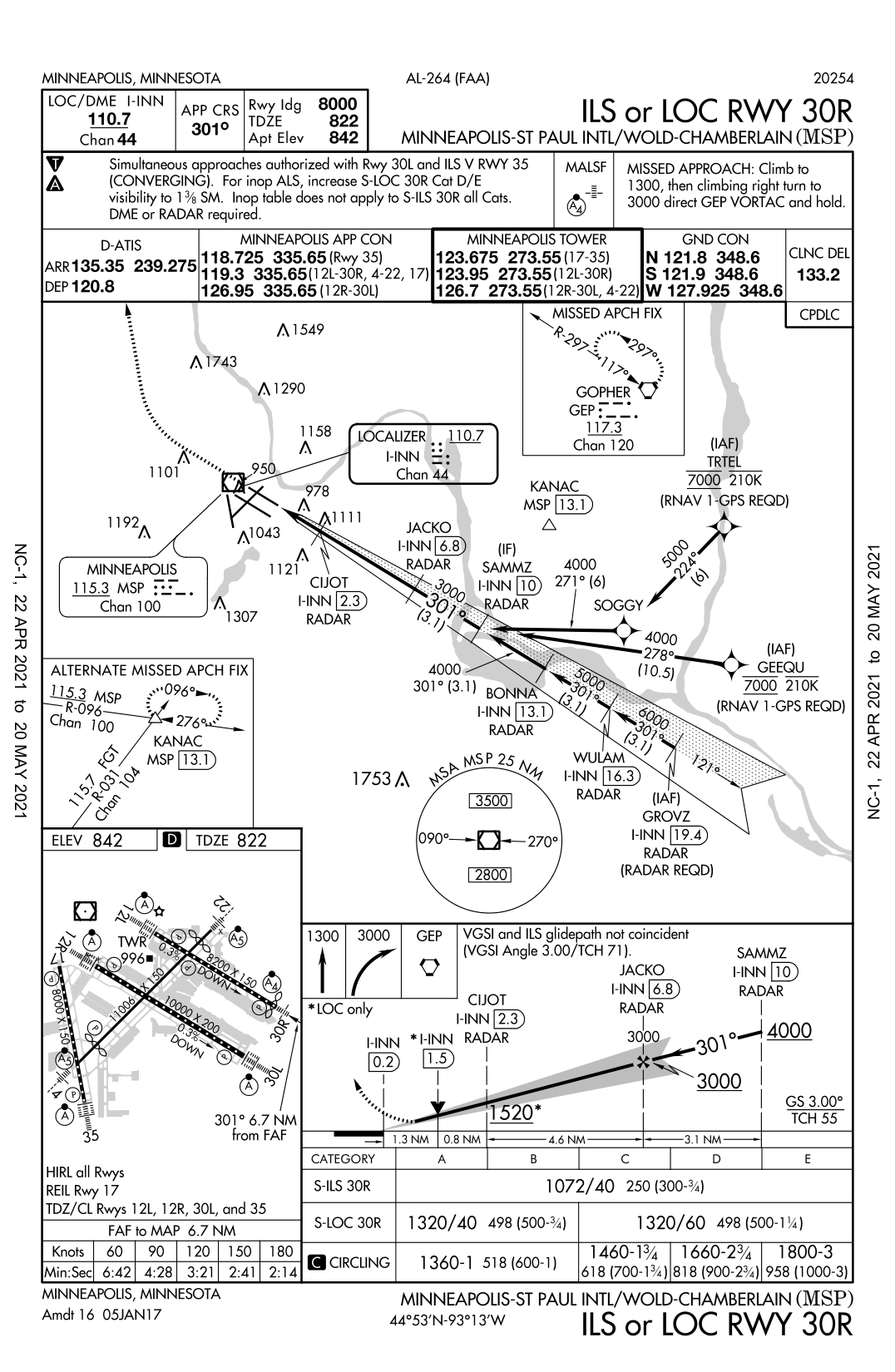
On the following ILS chart, there is a number 301°. Is the number 301° indicating a track angle, heading or something else?
2 Answers
An approach plate is a map, so the directional values presented are always magnetic track angles (except near the magnetic North Pole). A heading is where the airplane points when it's flying. So, 301° is the track of the localizer course, in degrees magnetic. Makes sense, as it's the approach to Runway 30.
In the Arctic, in some areas the magnetic compass is usable and some areas it's not, so the value will include a "T" (301°T) if the track is a True Track, or an "M" (301°M) if it's a Magnetic Track. If there is no T or M, assume the value is magnetic.
-
$\begingroup$ Are you sure it's not the required bank angle? $\endgroup$ Commented Mar 6, 2022 at 9:39
That is the final approach course on the localizer. You will fly that magnetic course once you are established on the localizer. Your heading used to track that final approach course will vary depending on the winds aloft.


APP CRSonly means "Approach Course" for those of us who are used to the jargon. And showing an approach angle on the bottom right glidepath has always been a confusing representation. Snappish responses might feel temporarily feel good, but they don't celebrate the learning and documentation process, which is what SE sites are about. $\endgroup$