I’ve seen some routes for flights from Asia (mainly Hong Kong and Shanghai) to the west coast of North America, which fly at lower latitudes than flights in the other direction (which they fly closer to the North Pole). From what I know, the jet streams go eastward, and are stronger near the poles. So why don't flights from Asia to western North America fly closer to the pole to take advantage of stronger tailwinds? Or did I get it wrong?
-
$\begingroup$ The jet streams don't occupy fixed positions. You'd either have to find actual winds aloft for the date of those flights, or do a statistical analysis of flight paths over a fairly long period. Here's a link to a real-time map of jet streams: netweather.tv/charts-and-data/global-jetstream#2019/12/14/1800Z/… Looks like today they're quite a bit to the south over the Pacific. $\endgroup$– jamesqfCommented Dec 15, 2019 at 4:14
-
$\begingroup$ Also note there is a Pacific Track system similar to the North Atlantic Tracks, that is shifted north and south based on winds like the NAT. $\endgroup$– John KCommented Dec 15, 2019 at 4:47
1 Answer
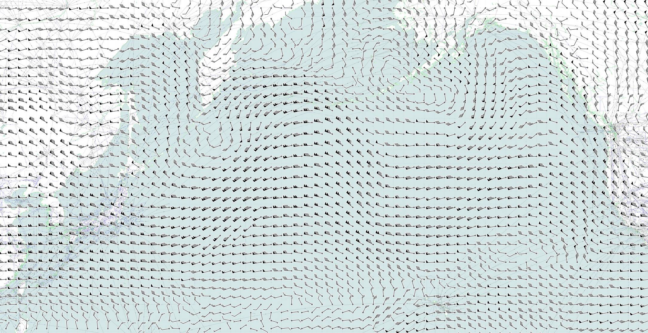
The different routes are due to the enroute winds created by the jet stream. The following map shows the current winds over the Pacific:

(map from skyvector.com)
You can see strong winds from the West in the central Pacific region of up to 150 knots (see here for a legend on how to read wind barbs). A flight from Hong Kong to Los Angeles benefits from these winds. A flight in the opposite direction would experience this as a headwind though and will therefore try to avoid the region. You can see that the winds are much weaker in the North.
In order to organize traffic in the Pacific, a track system has been established: Pacific Organised Track System (PACOTS).
The Pacific Organised Track System (PACOTS) is a flexible set of aircraft route tracks that primarily link commercial air transport gateways of Japan and Southeast Asia and the gateways of Hawaii and the North American West Coast, as well as those in Texas.
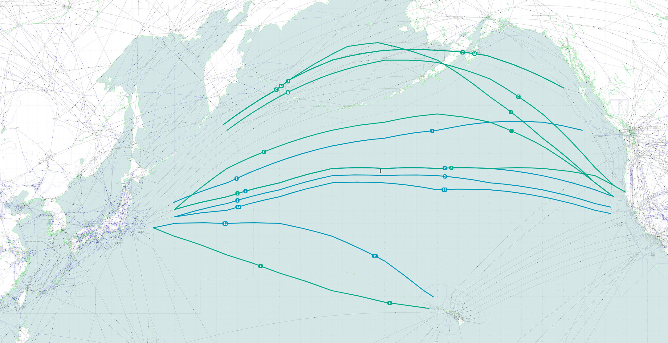
The following map shows the current PACOTS tracks:

(map from skyvector.com)
The green tracks are for westbound flights and the blue ones for eastbound flights. Due to the changes in the jet stream, these tracks are re-defined twice a day:
The tracks are developed twice daily by the Japanese Air Traffic Management Centre (ATMC) in coordination with Oakland ARTCC. Eastbound tracks are valid from between 0500Z and 1000Z (depending on origin) to 2100Z (with specified crossing time windows for 160E) and are given a numeric designator. The opposite direction westbound tracks are valid from 1900Z to 0800Z (with specified crossing time windows for 160E) and are designated alphabetically.
-
-
1$\begingroup$ Related (Atlantic): Why are westbound transatlantic routes located hundreds of km away from eastbound routes? $\endgroup$– user14897Commented Dec 15, 2019 at 18:57
-
$\begingroup$ For emphasis/clarity: "the current PACOTS tracks" were for the 12 hour period when this answer was written, since they can change two times per day. $\endgroup$– FreeManCommented Dec 16, 2019 at 13:55


