I am interested in the methods implemented by Flight Management Systems in order to calculate a trajectory path of vertical navigation guidance (VNAV), which takes into consideration the legs of the instrument procedures used for a flight plan, among other things such as aircraft's performance characteristics, wind etc.
In other words, a manual or a guide from official sources (for example, FAA, ICAO or Eurocontrol), but other reliable third-party solutions would also suffice.
I am mainly interested in a way to determine the vertical profile of an instrument flight procedure (SID, STAR, IAP) based on its legs and any crossing altitude or speed constraints that are assigned to any of their waypoints.
Can someone point me in the right direction? I am aware that there is not one way of determining the vertical profile of a route, however my guess is that some universally accepted guidelines must exist.
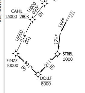
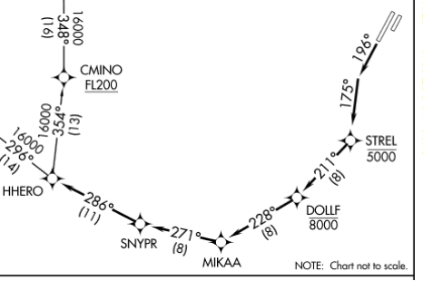
EDIT: I will provide some more information about what I have in mind, based on Noah's contribution. Let's take for example FINNZ2 and HHERO3 departure procedures of KSNA airport. We can see that some of the waypoints have crossing altitudes assigned.
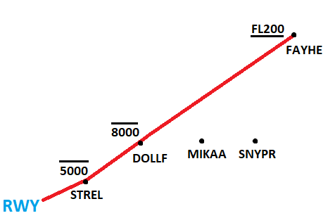
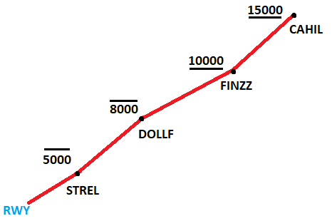
Can an acceptable implementation of vertical navigation be based on the aforementioned crossing altitudes, by considering them as mandatory altitudes that an aircraft must have while passing from them? This would mean that every such crossing altitude would be considered as "CROSS X AT Y ALTITUDE" restriction, even if it is At or Above, At or Below or Block.
Something like the following vertical profiles:
In other words, I am trying to figure out if this would be a useful or realistic information that an FMS would also provide.
My other idea would be to take a predefined climb gradient for the aircraft, let's say 500 feet per nautical miles and adjust the vertical path if any waypoint crossing altitude restrictions are violated.


