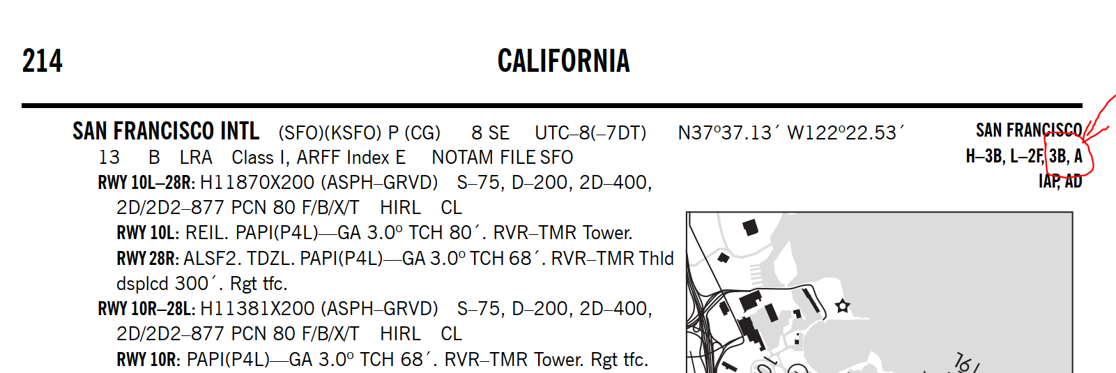
In the Chart Supplement, the airport information includes the chart on which the airport is located. It also includes a panel on the chart where the airport is located. How can I use this panel information? Sectional charts don't appear to have panels.
Here is the airport information for San Francisco International:

I understand that San Francisco stands for San Francisco Sectional Chart and H-3B and L-2F are for the IFR charts, but how can I use the 3B and A information?

